| OCR Text |
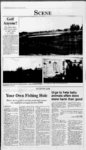
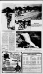
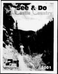
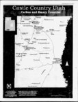
Show 2001 See & Do 27 Fishing the rivers and lakes of Castle Country continued from page 20 ceed east up canyon about 1 3 miles, then turn south on Forest trail 024 about 2 miles. There is a fork in the road, the road to the right goes to Deep Lake and Upper and Lower WPA Ponds, the road to the left goes to Shingle Mill Reservoir. This is a rough road with little or no maintenance. It is passable in a pickup, but a 4X4 or ATV is recommended. Do not enter this road if a storm is approaching. 12-mi- le Elevationsizemax. depth: 1 acre, 10 feet. Sport fish speciessize: Brook trout Special fishing regulations: None. Specific fishing tips: Night crawlers, small spinners, dry 9,300 feet, flies. Boating information: No boat access Other: Primitive camping no facilities, take out all you take in. This is an old reservoir that was breached. Beaver have built a dam across the breach. The pond is stocked annually but may be subject to winter kill so may not always have fish. MARYS LAKE Directions & access: From the south side of Joe's Valley Reservoir, take Forest Service Road 041. From Joe's Valley Reservoir, the road is a primitive roadbed with exposed rocks and boulders. Snow and mud may prevent access from until July. Elevationsizemax. depth: Approx. 8,900 feet, approx. 10 acres, (no data). Sport fish speciessizes: Primarily rainbow trout. Some mid-Octob- er effective later in the summer season. Boating information: Boat trailers may back through dirt and mud into shallow water on the north side. Most access is across private land. Please exercise respect for the land. Pick up litter and leave the area cleaner than you found it. Other: No camping, toilet or picnic facilities at the reservoir. Please pack out trash. Elevationsizemax. depth: 8,840 feet, 6 acres, 16 feet. Sport fish speciessize: Stocked rainbow trout, Special fishing regulations: None. Specific fishing tips: Night crawlers, power bait, small spinners and dry flies. Boating information: No boat access. No Small be watercraft may ramp. carried to the water. Other: Limited camping is available around the lake. Use of live bait is illegal and Directions & access: Travel highway 89 to Sterling, turn east on the Six Mile Canyon road for about one mile to reach Palisade Reservoir. There is a Palisade State Park sign on Highway 89 in Sterling. mouth of Ferron Canyon. Elevationsizemax. depth: feet, 435 acres, 102 feet. Sport fish speciessizes: Rainbow, splake, and cutthroat inches. trout. Trout are Special regulations: None. Elevationsizemax. depth: 1 5,873 feet, 85 acres, 38 feet. Sport fish speciessize: Stocked rainbow trout and cutthroat inches. trout Special fishing regulations: 9-- 5 Specific fishing tips: Traditional baits such as worms and marshmallows, cheese, and have been tradiPowerbait tionally good choices. A gold None. Specific fishing tips: Great family fishing fun, night crawlers, small spinner, power bait. Boating information: Fishing from a boat with any kind of motor is prohibited. is effective Jake's in the late fall. Boating information: Cement boat ramp and docks, operated by Millsite State Park. Other: The state park feaSpin-A-Lu- best bait. Boating information: very expensive. Help us use your tax dollars more effectively. Please make sure your bait fish are dead. Have fun. ..and take a kid fishing! Start a tradition by sharing your enjoyment with the next generation. Special thanks to the Utah Division of Wildlife Resources for this information. PALISADE RESERVOIR MILLSITE RESERVOIR Directions & access: Two miles west of the town of Ferron, just beyond the golf course at the 6,21 are closed from January 1 unthe 2nd Saturday in July. Specific fishing tips: Worms seem to have been the til re PETES HOLE RESERVOIR Directions & access: Travel west from Joe's Valley Reservoir on State Road 29. Turn at tures excellent camping, restroom and picnic facilities. Forest Service sign. Snow, shut off access along the dugway which can be treacherous. Elevationsizemax. depth: NEW CANYON RESERVOIR Directions & access: Travel highway 89 to Ephraim, pro- rain and mud can ceed east up Ephraim Canyon to the mouth of about the canyon. Take Forest trail 039 to the north about 3.5 miles to the reservoir. 8,867 feet, 13 acres, 17 feet. Sport fish speciessizes: Rainbow and cutthroat trout. Special regulations: Tributaries $CfCCCJCC(tCCCCCCtCtCtCtCCCtCC S brook trout may also be present. Special regulations: None. Specific fishing tips: Worms are the best bait. For spincasting and fly fishing refer to section in this brochure on general recommendations. Boating information: Small watercraft must be carried to the water. Other: No toilet facilities. $ MILLER FLAT RESERVOIR $ Directions access: About three miles south of Cleveland Reservoir on Forest Service Road 014. During the spring y snow melt period from to early June, the forest service road is closed to protect the road surface. Elevationsizemax. depth: 8,462 feet, 160 acres, 64 feet. Sport fish speciessizes: Rainbow trout. Special regulations: None. Specific fishing tips: Worms $ $ $ $ & mid-Ma- and marshmallows or Powerbait are a sure bet for bait fishermen. Lures can be MOO - $500 If You Need Money For Your $ $ $ $ $ $ $ $ $ $$ Vacation... See Us Now! Good Only if Presented BEST WESTERN To: RIVER TERRACE Security Finance 255 East Main Street Price, Utah 84501 613-915- 9 MOTEL i 880 East Main St. Green River, Utah (435) 564-340- Fax (435) 1 564-340- 3 |