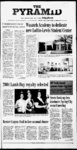
| OCR Text |
Show THE 8 hearing notice for Fairview RDA PUBLIC NOTICE as Substantive comments are those within the scope of, are specific to, and have a direct relationship to the proand action, posed include supporting reathat the sons Officials Responsible should consider in a reaching decision. Each individual, or from representative each organization, subsubstantive mitting comments must either sign the comments or otherwise verify indenti-t- y in order to attain oak with the herbiTebuthiuron cide (Spike) following this or hand treatment mechanically treat oak, white fir and on approximately 121 acres. Treatment would begin in 2005 and should be completed by 2008. An Environmental Assessment (EA) that discloses the effects of er pinion-junip- implementing the pro- posed action has been completed. The EA and associated environmen- project website at http:www.fs.fed.usr4 The public is invited to comment on our pro- posed action. Only those who submit timely and substantive comments will be accepted 6. - 67.04' to a Point; thence East a distance of 500.00' to a Point; thence East a distance of 570.77' to a Point; thence North a distance of 256.08' to a Point; thence N16 Deg. 0332"E a distance of to a Point; 76.26' thence N00 Deg. 13'45"E a distance of 1953, that as the Board of Directors the Redevelopment of Agency of Fairview City (the "Agency") have scheduled a public hearing on Monday, April 12, 2004 at 6:30 p.m. or as soon thereafter as reasonably feain the sible, City Council Chambers, comment ends 30 days following the date of publication of this legal notice in the (Official Paper of Record). If you have any questions or would like a copy of the EA and FONSI sent to you, please contact Diane Cote, Team Leader, 540 Fairview 499.75' to City Hall, 85 PUBLIC HEARING The purposes of the as hearing, public required by Sections and Utah Code Annotated 1953, as amended, will be to: Main, (1) allow public comment on the draft proposed project area plan (the "Project Area for the Plan") 283-415- Published in The Pyramid April 8, 2004. Notice of trustee sale Downtown Redevelopment Project highest bidder, payable in lawful money of the United States, at the West entrance of the County Sanpete Courthouse at 160 North Main, Manti, Utah, for the purpose of foreclosing a trust deed executed by KATHERINE G. BROWN as Trustor, in favor of CENUTAH TITLE as Successor Trustee for the benefit and security TRAL STATES of UNITED OF DEPARTMENT AGRICULTURE as Beneficiary and dated 1996 and 8, May recorded May 17, 1996 as Entry No. 44081 in 2 Book 379 at pages of Official Records in the office of the Sanpete County Recorder, covering the following described real property purported to 959-96- in said to the trustee a $5,000.00 deposit at the sale and the balance of the purchase price by 12:00 noon the day following the sale. Both the deposit and the balance must be in the form of a wire transfer, cashier's check or certified funds payable to Central Utah Title. Cash payments are A not accepted. trustee's deed will be delivered to the successful bidder within three business days after receipt of the amount bid. DATED: April 2, 2004. Sanpete, State of Utah (the undersigned disclaims liability for any error in the address), and more particularly described as follows: The West half of Lot 3, Block 17, Plat B", WATKINS MT. ADDITION TO PLEASANT CITY SURVEY, Sanpete County, State of Utah. The current beneficiary of the trust deed is UNITED STATES DEPARTMENT OF and the record owner of the property as of the recording of the notice AGRICULTURE CENTRAL G. will BROWN. Said sale without be made covenant or warranty, expressed or implied, regarding thence West thence West a distance of 126.72' to a Point; thence South a distance of 272.58' to a Point; Point; thence West a distance of 58.72' to a Point; thence N52 Deg. 48 07"W a distanceof 155.12' to a Point; thence North a distance of 228.27' to a Point; thence West a distance of 66.00' to a Point; thence North a distance of 220.44' to a Point; (1) A description of the boundaries of the Project Area being proposed for redevelop thence West a distance of 215.12' to a Point; thence North a distance of 236.28' to a Point; thence West a distance of 218.46' to a Point; thence West a distance of 73.34' to a Point; thence North a distance of 233.29' to a Point; thence West a distance of 247.50' to a Point; thence North a distance of 31.72' to a Point; thence East a distance of 247.50' to a Point; thence North a distance of 176.22' to a Point; thence West a distance of 247.50' to a Point; thence North a distance of 68.83' to a Point; thence East a distance of 247.50' to a Point; thence North a distance of 148.50' to a Point; thence West a distance of 429.00' to a Point; S00 thence Deg. 00'01E a distance of 363.00' to a Point; thence N47 Deg. 22'34"W a distance of 341.12' to a Point; thence North a distance of 132.00' to a Point; thence West a distance of 187.02' to a Point; thence West a distance of 184.80' to a Point; thence South a distance of 495.00' to a Point; thenceEast a distance of 29.70' to a Point; thence South a distance of 264.00' to a Point; thence East a distance of 491 .57' to a Point; thence S24 Deg. 39'16"E a distance of 337.93' to a Point; thence East a distance of 454.49' to a Point; a disthence South tance of 384.76' to a Point; thence East a distance of 429.00' to a Point;thence SI 9 Deg. 23'40"E a distance of 383.68' to a Point; thence East a distance of 249.48' to a Point; thence South a distance of21 4.83 to a Point;' thence S08 52'18"E a distance of 64.73' to a Point; thence South a distance of 512.16' to a Point; thence SOI Deg. Notice of water conservancy meeting Office Hours 9:00 title, posses- am-5:0- The regular meeting of the Sanpete Water County Conservancy District board of trustees will be held on Thursday, 0 pm. Glen R. Green, President. Published in The Pyramid April 8, 15 and 22, 2004. condition or sion, encumbrances to satisfy the obligation secured by and pursuant to the power of sale conferred 38'32"E a distance of 50.94' to a Point; thence South a distance of 500.00' to a Point; thence S02 Deg. 48'51"W a distance of to a Point; 81.47 thence South a distance of 506.88' to a Point; thence South a distance of 31 9.61 'to a Point; thence East a distance of 115.00' to a Point; thence South a distance of 36.00' to a Point; thence East a distance of 11.25' to a Point; thence South a distance of 66.00' to a Point; thence West a distance of 24.27' to a Point; thence South a distance of 148.50' to a Point; thence East a distance of 150.14' to a Point; thence South a distance of 347.72' to a Point; thence West a distance of 252.12' to a Point; thence South a distance of 252.12' to a Point; thenceSI 9 Deg. 24'11E a distance of 61.10' to a Point; thence South adistance of 252.12' to a Point; thence West a distance of 20.12' to a Point; thence South a distance of 253.44' to a Point; thence East a distance of 252.12' to a Point; thence N82 Deg. 56'21'E adistance of 70.68' to a Point; thence East a distance of 252.12' to a Point; thence North a distance of 506.88' to a Point; N44 thence Deg. 51'23"W a distance of 75.76' to a Point; thence North a distance of 253.44' to a Point; thence West a distance of 37.12' toa Point; thence North a distance of 157.50' to a Point; thence East a distance of 40.00' to a Point; thence North a distance of 182.81' to a Point; thence East a distance of 47.12' to a Point; thence North a distance of 122.10' to a Point; thence East a distance of 102.00' to a Point; thence N67 44'24'E a distance of 162.21 'to a Point; thence North a distance of 66.45' to a Point; thence West a distance of 252.12' to a Point; thence a North distance of 250.00'to a Point; thence N00 Deg. 01'32"E a distance of 70.10' to a Point; thence East a distance of 252.12' to a Point; thence North a distance of 250.16' to a Point; thence West a distance of 158.40' to a Point; thence North a distance of 58.72' to a Point; thence North a distance of 197.98' to a Point; thence West a distance of 93.72' to a Point; thence N04 Deg. 07'50"W a distance of 69.42' to a Point; thence North a distance of 512.16'. to a Point; thence N02 39'14"E a distance of 50.97' to a Point; thence North distance of 512.16' a toa Point; thence N03 Deg. 17'11"E a distance of 63.94' to a Point; thence North a distance of 256.08' to a Point; to the Point of Beginning; Total area contained within the boundary is 127.59 acres. Private contained property within the boundary is 96.19 acres. (2) A map showing the boundaries of the proposed Project Area is available for inspection at the offices of the Redevelopment Agency located at 85 South State, Fairview, Utah; (3) If the Project Area Plan and Budget are adopted, then proptax revenues erty an from resulting increase in valuation of within the property proposed Project Area will be paid to the Agency for redevelopment purposes rather than to the taxing entity to whichthe tax revenues would otherwise have been paid if: (i) a majority of the taxing entity committee consents to the Project Area Budget; and (ii) the Project Area Plan provides for the Agency to receive tax increment. (4) Any person objecting to the proposed draft Project Area Plan or contesting the regularity of any of to the proceedings it may appear adopt the Agency before Board at the hearing to show cause why the proposed draft Project Area Plan should not be adopted, or mayfile with the Agency written objections prior to the time and date of the public hearing showing cause posed the why April 15, 2004 at 7 PM in the Sanpete County agenda please call the secretary at (435) Courthouse, commissioner's room. 835-567- be Anyone wanting to on the meeting 1. pro- The proposed' Project Area Plan and Budget are available for (5) at the inspection Agency offices; contact Woodside, Nancy Executive Director of the Agency at 85 South State, Fairview City, Utah. The Agency is willing to meet and answer any questions you may have. If you have questions or desire to meet, please contact Nancy Executive Woodside, Director of the Agency at (435) The Area Plan and Project and Budget are proposals at this point and the Agency is interested in Published in The 8, April Pyramid 2004. Rights. (The Period of Use is generally year-roun- d except irrigation which is generally from Apr 1 to Oct 31 each ments and tions. order of the By Board of Directors of the Redevelopment Agency of Fairview City, this 8th day of March 2004. REDEVELOPMENT AGENCY OF FAIRVIEW CITY Harvey Worley, Chair; Nancy Woodside, Executive Director Published in The Pyramid March 18 and 25, April 1 and 8,' 2004. G http:waterrights.utah. gov or call Persons objecting to an application must file a CLEARLY READABLE protest stating FILING NUMBER, REASONS FOR OBJECTION, PROTESTANTS' NAME AND RETURN ADDRESS, and any request for a hearing. Protest must be filed with the State Engineer, Box 146300, Salt Lake City, UT 84114-630- 0 on or before MAY 5, 2004. These are informal proceedings as per Rule R655-6-- 2 of the of Water Division Six county The Six Association Governments Gary Colc, Jr., DO Announcing open practices and short waiting times at the IHC Health Center - Mt. Pleasant Weve opened our physicians practices and extended our hours to better accomodate your needs. Our family practice physicians provide the full spectrum of health care, and accept walk-inand new patients. s County of Area Agency On Aging is now accepting bids for services such as homemaker and personal care services for the homebound on Title lll-and Home Based Community The Alternatives, Support Caregiver Program and the Aging Waiver Medicaid Program. Six County will also Company propose(s) using 196.1845 cfs. from Ephraim Cottonwood Creek (Ephraim Area) for APPLICA- TIONS): Andrew J. Christiansen using propose(s) 0.00073 cfs or 0.53 t. from groundwater (0.5 miles SW of Mt. for Pleasant) ac-f- Stockwatering; and S Van Orman Family Trust propose(s) using 0.0058 cfs or 1 .0 ac-f- t. from groundwater (1 mile West of Chester) for Irrigation; Stockwatering. EXTENSION(S) Domestic. C. Stephen Claudette S. and Barratt propose(s) 0.5 using from ac-f- t. groundwater (408 Hideaway Valley, Indianol) for Irrigation; Domestic. Recreational Unlimited Lands Inc.; Pines Whispering Water Co. are filing an extension for 1.139 cfs or 241.31 ac-f- t. (5 SE Miles Mt. of Pleasant) for Domestic. Jerry D. Olds, P.E. STATE ENGINEER State of Utah Board of Water Resources, Irrigation Ephraim Published in The Pyramid April 8 and 15, 2004. services bid in-ho- me bids for secondary meals, adult day care for the Aging Medicaid Program and for assistive devices and for the supplies Caregiver Program. Specific bid information may be obtained by calling or writing to; Six County Area Agency On Aging, 250 North Main, Richfield, Utah 84701, All bids are confidential and must be received in the Six be accepting County office by no later than noon on May 14th, 2004. The Six County Association ol Governments reserves the right to accept andor reject any or all bids. Judy Christensen, AgingNutrition Program Manager Six County Area Agency On Aging. Published in The Pyramid April 8 and 15, 2004. And we also support pharmacy patient assistance programs for qualified individuals. Call us today. IHC your home a new look with a Decorative Overlay surfaces for wood Give IHC Health Center A Service of Imermountain Health Care MT. PLEASANT 1 100 South Medical Drive 462-34- 71 Open Monday through Friday 9:00 am to 5:00 pm Evening lours: Monday through Thursday 6:30 pm to 9:00 pm. I Doctors, hospitals A and health plans working together for you. like floors, driveexisting ways, sidewalks, porches, patios, foundations, interior & exterior. We pour new sidewalks, driveways, patios and porches. Crack Repairs 851-00- 58 ; your comsugges- receiving Irrigation. year.) CHANGE ' 427-385- 8. Nnf jpp f a wa tgf US6FS The State Engineer received the following in Application(s) County Sanpete (Locations in SLB&M). For more information or to receive a copy of visit filings, ' draft Project Area Plan should not be adopted. Oral and written objections will be received and considered at the public hearing. UTAH TITLE, Trustee 140 North Main, Manti, UT 84642 of default is KATHERINE thence a distance of 247.50' to a Point; thence South a distance of 147.80' to a Point; thence West a distance of 0.81' to a Point; thence South a distance of 238.26' to a Point; "Project (the Area") and on the related draft project area budget (the "Project Area or Budget" "Budget"); (2) allow public comment on whether the draft Project Area Plan and Area draft Project be should Budget or revised, adopted and (3) rejected; all receive written objections and hear all oral objections to the draft Project Area Plan. Notice is hereby given of the following: Trust Deed. Bidders must tender be located at 565 South in the City of Mt. Pleasant, County of 300 East Point; North a distance of 216.94' to a Point; thence North a distance of 147.80' to a Point; Area On May 4th, 2004 at 11:00 a.m. of said day the following described property will be sold at public auction to the a thence North a distance of 943.33' to a Point; thence West a distance of 601.94' to a Point; thence South a distance of 885.72' to a Point; thence Westa distance of 506.22' to a Point; thence S33 Deg. 13'54" E a distance of 144.30' to a Point; thence West a distance of 50.86' to a Point; thence South a distance of 142.76' to a Point; thence West a distance of 495.00' to a Point; thence West a distance of 155.45' to a South State, Fairview City, Utah. PURPOSES OF THE Ephraim, 84627 or call (435) UT 17B-4- Utah Code Annotated amended, ing Federal Holidays. The opportunity to North 17B-4- thence N85 Deg. 45'00"E a distance of Point; 17B-4-70- exclud- Monday-Frida- begins 249.48' east and 256.08' south of of corner property State Highway 89 and 400 north, Beginning at a Point; thence East a distance of 249.48' to a 701(1)(c) and (e) and 2 and (2)(b), 283-415- 1, 283-561- appeal eligibility. Comments received in response to this solicitation, including names and addresses of those who comment, will be considered part of the public record for this project. Comments should include the information required pursuant to 36CFR 215.6(a)(3), as published in the Federal tal analysis documents can be viewed on the Sections )(d), 501 (2)(c), is as follows: Said point of beginning City) NOTICE IS HEREBY GIVEN, pursuant to of the provisions Register on June 4, 2003. Please send written comments to: H. Thomas Shore, District Ranger, Ranger Sanpete District, 540 N. Main, Ephraim, UT 84627, phone: (435) fax: (435) Comments may also be delivered to the above address during regular business hours of 8:00 a.m. to 4:30 p.m., appellants. ment (Public Hearing On Redevelopment Project Area Plan And Budget) (Board of Directors of the Redevelopment Agency of Fairview Proposed action Whispering Pines hazardous fuels project The Sanpete Ranger District is proposing to treat 115 acres of gam-b- el April 8, 2004 PYRAMID |