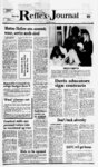
| OCR Text |
Show JUNE 9, 1987 L, objection to its approval only if it is on one of the following bases: (a) that the certification Combined Notice FONSI-NOIRRO- F Finding of No Signifcant Impact and Notice of Intent to Request Release of Funds Public Notice Advertising Protects Your Right To Know Davis CountyDavis COG, 28 East State Street, Farmington, 1 Utah 84025 NOTICE There will the project. This Environmental Review Record is on file at the following location and is available for public exami- nation and copying, upon request: Davis County East State St., Farmington, Utah 34 84025, (801) No Cancellations 451-327- 8 Davis County will undertake the project described above with Block Grant funds of Legal Notices in the Davis Reflex-Journ- al from the STATE under Title I of the Housing and Community Development Act of 1974. Davis County is certifying to the STATE that Davis County and Commissioner Harold J. Tippetts, in his official capacity as Davis County Commission Chairman, consent to accept the jurisdiction of the Federal courts if an action is brought to enforce responsibilities in relation to en- after 4 p.m. Friday vironmental reviews, and action; and that these responsibilities have been satisfied. The legal effect of the certification is that upon its approval, Davis County may use the Block Grant funds, and the STATE will have satisfied its responsibilities under the National Endecision-makin- NOTICE TO CREDITORS AND ANNOUNCEMENT OF APPOINTMENT Probate No. 3500 Estate of Hoyt S. Wimer, Deceased. P. Jeneal Wimer whose address is 1259 South 325 East, Bountiful, Utah 84010, has been appointed Personal Representative of the estate of the above-name- d decedent. Creditors of the estate are hereby noti- g, vironmental Policy Act of 1969. STATE will accept an objection to its approval of the release of funds and acceptance of the certification only if it is on one of the following bases: (a) That the certification was not in fact executed by the chief executive officer or other officer of applicant approved by the STATE; or (b) that applicants environmental review record fied to present their claims to the above Personal Representative or to the Clerk of the Court within three for the project indicates omission of a required decision, find-- , ing, or step applicable to the project in the months after the date of the fust publication view process. Objections must be prepared of this notice or be forever barred. DATED this of May, 1987. 19 day P. Jeneal Wimer Personal Representative Dean C. Andreasen Sessions & Moore Attorneys for P. Jeneal Wimer 505 East 200 South, Suite 400 Salt Lake City, Utah 84102 Published in the Davis Reflex Journal First publication May 26, 1987 Last publication June 9, 1987 Issue No. 17 R-9- 1 Published in the Davis County Clipper First publication May 28, 1987 Last publication June 11, 1987 Issue No. 18 C-2- NOTICE OF INTENT TO REQUEST RELEASE OF FUNDS TO ALL INTERESTED AGENCIES, GROUPS AND PERSONS: On or about June 1 1 , 1987 Davis County will request the STATE to release Federal funds under Title I of the Housing and Community Development Act of 1974 (PL 93-38- 3) for the following pro- ject: PROJECT TITLE Davis County Eco- Environmental Re- and submitted in accordance with the required procedure (24 CFR Part 58), and may be addressed to STATE Department of Community and Economic Development, 6290 State Office Building, Salt Lake City, Utah 84224. Objections to the release of funds on bases other than those by STATE. No objections received after June 26, 1987 will be considered by STATE. Harold J. Tippetts, Chairman Davis County Commission P.O. Box 618 Farmington, Utah 84025 Published in the Davis County Clipper on June 4, 1987 Issue No. 19 C-2- Published in the Davis Reflex Journal on June 9, 1987 Issue No. 20 R-1- NOTICE OF SHERIFFS SALE ON REAL PROPERTY Civil No. 38862 ROBERT L BURTON, JUDY BURTON, TRANSPORT DUCTS, INC., AKA A U G H W I C K FABRICATING CO., INC., FIRTS SECUR- person. Clearfield City, Davis County CO., LTD., AND COST OF PROJECT (CDBG Portion) $80,000 An Environmental Review Record respecting this project has been made by Davis County which documents the ITY BISHOP MACHIN- ESTIMATED en- vironmental review of feet along the center of said railroad right of way to the center of a County Road and South 45 degrees 1335 West 855.47 feet along the center of said road and South 44 degrees 4625 East 578.70 feet from the Northeast corner of the North- west Quarter of Section 4, Township 3 North, Range West, Salt Lake Meridian, in the City of Kaysville, and running thence 1 North 41 degrees 3535 East 105.15 feet to the center of Holmes Creek; thence North 35 degrees 11 45 West 330.92 feet along the center of said creek; thence South degrees 2920 East 991.32 feet; 55 thence South 49 51 de-gre- es West 245.74 feet; thence South 54 degrees 4530 West 216.53 feet; thence North 33 degrees 3936 West 587.90 feet to the point of beginning. - TOGETHER WITH AND SUB- JECT TO A RIGHT OF WAY: Beginning on the Southeasterly line of a 2 rod county road at a point North 89 degrees 1350 West 157.08 feet along the Section line to the center of the D. & R.G.W. Railroad Right of Way and North 34 degrees 4033 West 143.56 feet along the center of said railroad right of way to the center of a County Road and South 45 degrees 1335 West 855.47 feet along the center of degrees 4625 East 16.5 feet from the Northeast corner of the Northwest Quarter of said 44 Section 4, and running thence South degrees 4625 East 592.20 feet; thence South 45 degrees 1335 West 20.0 feet; thence North 44 degrees 4625 West 592.20 feet to the South- easterly line of said road; thence North 45 degrees 1335 East 20.0 feet along said road to the point of beginning. aka: 1191 West Webb Lane, Kaysville, Utah 84037. DATED AT FARM- INGTON, DAVIS COUNTY, UTAH, this 26th day of May, 1987. Brant L. Johnson, Sheriff Davis County AND BANK OF UTAH, N.A., LOCATIONS right of way and North 34 degrees 4033 west 143.56 liens. vs. MACHINE expansion, thereby creating jobs for low moderate income The land referred to in this Report is situated in the State of Utah, County of Davis, and is described as follows: Beginning at a point North 89 degrees 13 50 West 157.08 feet along the Section line to the center of the D. & R.G.W. Railroad IN THE DISTRICT PAYMENT TO BE COURT OF DAVIS COUNTY, STATE MADE IN lawful OF UTAH money of the United KENZIE W. KING States of America. AND KAYE KING, SUBJECT TO any Loans to PROJECT a private business for OF scribed real property, to wit: EXHIBIT A SCHEDULE C 44 Revolving Loan Fund Oakline (RLF) PURPOSE de- said road and South CLEARINGS INTERMOUNTAIN, INC., MONROE PROMENTAL nomic Development the following Plan- ning Dept., Davis County Courthouse, be exempt interest of the defendant, Robert L. Burton et al., in and to ERY AND SUPPLY PENSKE TANK CO. TO BE SOLD AT A SHERIFFS SALE on the 18th day of June, 1987, at the hour of 12 noon at the north front door of the Davis County Courthouse in Farmington, Davis County, Utah, all the right, title and non By: Stan Tebbs Deputy Sheriff Glen T. Celia, Attorney 251 East 200 South Clearfield, Utah 84015 825-220- 2 Published in the Davis Reflex Journal First publication June 2, 1987 Last publication June 16, 1987 Issue No. 19 R-1- 451-327- 8 ALL TO : was not in fact executed by the certifying officer or other officer of applicant approved by DCD or (b) that the applicant's AGEN- CIES, GROUPS AND PERSONS; On or about June 1 1 , 1987 Davis County will request the Utah Division of Community development to release funds provided under Title I of the Housiqg and Community. De- -, velopment Act of 1974, as amended (PL for the following project: Economic Development Revolving Loan Fund (RLF), Energy Machine Service Business Expansion and Job Creation 93-38- North Salt Lake City, Davis County, Utah FINDING OF NO SIGNIFICANT IMPACT It has been determined that such request for release of fiinds will not constitute an action significantly affecting the quality of the human environment and accordingly Davis County has decided not to prepare an En- vironmental Impact Statement under the National Environmental Policy Act of 1969 (PL The reasons for such decision not to prepare such Statement are as follows: an environmental assessment has been performed in compliance, 24 CFR 58, potential impacts and appropriate mitigation measures have been identified and it has been determined that there will be no significant impact. An environmental Review Record environmental review record for the project indicates omission of a required decision, applic- finding or step able to the project in the environmental review process. Objections must be prepared and submitted in accordance with the required procedures (24 CFR 58) and may be addressed to: Divi- -' CDBG Program, sion of Community Development, 6233 State Office Building, Salt Lake City, Utah 84114. Objections to the release of funds on bases other than those stated above will not be considered by the Division De- of Community velopment. No objection received after June 26, 1987 will be considered by the Division of Community Development. Richard J. Mayfield, Certifying Officer Director Davis County Planning Department Davis County Courthouse Farmington, Utah comments for con- sideration by Davis County to the above address on or before June 19, 1987. All such comments so received will be considered and Davis County will not request release of funds or take any administrative action on the projection prior to the date specified in the preceding sentence. RELEASE OF FUNDS Davis County will undertake the project described above with CDBG funds provided by the Utah Division of Communinity Development (DCD) under Title I of the Housing and Com- munity Development Act of 1974, as amended. Davis County is certifying to DCD that Davis County and Harold J. Tippetts, in his official capacity as County Commission Chairman consent to accept the jurisdiction of the Federal courts if an action is brought to enforce responsibilities in relation to environmental reviews, decisionmaking, and action; and that these responsibilities have been satisfied. The legal effect of the certification is that upon its approval, Davis County may use the CDBG funds and DCD will have satisfied its under the National Environmental Policy Act of 1969. OBJECTIONS TO STATE RELEASE OF FUNDS DCD will accept an containing C-2- Published in the Davis Reflex Journal on June 9, 1987 Issue No. 20 R-1- NOTICE OF TRUSTEES SALE The following described property will be sold at public auction to the highest bidder on the 30th day of June, 1987, at 10:00 a.m., at the north entrance to the Davis County Court House at Farmington, Utah in the County of Davis, LOAN ASSOCIA- TION by reason of the breach of certain obli-gatio- secured thereby. Notice of Default was recorded February 20, 1987 as Entry No. 773631 in Book 1146 at Page 15 of said Official Records. Trustee will sell at public auction to the highest bidder for cash payable in lawful money of the United States at the time of sale, without warranty as to title, possession or encumbrances, the following described property at 2988 South Cave Hollow Way, in the City of Bountiful, County of Davis, State of Utah: A parcel of ground located in Davis County, state of Utah and described more particularly as follows: Beginning at a point on the South line of Section 33, Township 2 North, Range 1 East, Salt Lake Base and Meridian, which is South 4857" 88 degrees East 777.38 feet along said South line from the South Quarter corner of said section 33; and running thence North grees 1 1 03 5 de- East 349.33 feet to the South Line of a dedicated street, at a point on a 174.11 foot radius curve to the left, (Radius point bears North 3 degrees 0201 East); thence Easterly along said curve 23.83 feet; thence continuing along said South street line North 85 1127 degrees East 76.47 feet; thence leaving said street South grees 0116 10 de- East 364.26 feet to the South line of said feet; thence South 0 SECURITY TITLE COMPANY West 330.0 feet; Trustee degrees 0833 1.19 acres. Subject to and together with a 20.0 foot Right of Way the centerline of which is described as follows: Beginning at a point on the West line of Lot 2, Cave thence South 89 degrees 54 15 West 340.0 feet: thence North 0 degrees Hollow Estates (Unrecorded plat) which is South 88 2, 1987 North Issue No. 19 0 degrees 4857 East 777.38 feet 0833 line and North 5 degrees U03 East 166.00 feet from the South 14 comer of Section 33, Township 2 North, Range 1 East, Salt Lake Base and Meridian; East 140.0 feet; along the section said point also being on a 35.00 foot radius curve to the rights (radius point bears North 35 degrees 1446East) and running thence Northerly along said curve 36.73 feet to a point on a 145.00 foot radius curve to the right (radius point bears South 84 3730 East 54 15 The following feet to the Point of commencement as defined and scribed in the Sundowner Condominium, Phase One in Book 532 at Page 190 of Official Davis County Records. Dated: May 28, 1987 PRUDENTIAL FEDERAL SAVINGS AND LOAN ASSOCIATION, as Trustee East); thence along said curve 97.12 feet; thence North 43 de- South line of a dedi- which South 85 degrees 11 27 West 26.00 feet from the Northeast comer of said Lot 2. for the purpose of paying obligations secured by said Deed of Trust including fees, charges and expenses of Trustee, advances, if any , under the terms of said Deed, interest thereon as in said Note and by law provided. DATED this 26th day of May, 1987. PRUDENTIAL FEDERAL SAVINGS & LOAN ASSOCIATION R. Dale Potter Attorney and Authorized Agent for Prudential Federal Savings & Loan Association Trustee Published in the Davis Reflex Journal First publication June 2, 1987 Last publication June 16, 1987 Issue No. 10 R-1- NOTICE OF TRUSTEES SALE The following de- scribed property which will be sold at public auction to the highest bidder, pay- able in lawful money of the United States at the time of sale, at the DAVIS COUNTY COURTHOUSE, Farmington Utah, Davis County, Utah on June 29, 1987, at 9:00 a.m., of said day, for the purpose of foreclosing trust deed executed by ZELMO O. as MARSHALL, Trustors, in favor of PRUDENTIAL FED-ERA- L SAVINGS AND LOAN ASSO- CIATION, as Benef- iciary covering real property located at 755 SOUTH 1600 EAST, CLEARFIELD, UNIT UTAH B, BUILDING 8, and more particularly described as: Unit B in 8, as Building shown in the Record of Survey Map for THE SUN- DOWNER, PHASE ONE, appearing in the records of the County Recorder of Davis County, Utah, in Book S of Liens and Leases, at page 567, being a Condominium development located as follows: Commencing at a point on the South right of way of 700 South Street being West 1687.93 feet, South 112.57 feet and South 89 degrees 54 15" West 90 feet from the Northeast comer of Section 7, Town- ship 4 North, Range 0 West, Salt Lake Base and Meridian, and running thence South 0 degrees 0833" West 150.0 feet; thence North 89 degrees 54 15 East 170.0 feet; By Thomas W. Winther Published in the Davis Reflex Journal First publication June 2, 1987 Last publication June 16, 1987 Issue No. 19 R-1- NOTICE OF TRUSTEES SALE The following described property will be sold at public auction to the highest bidder on the 30th day of June, 1987 at 11:00 a.m., at the north front door of the Davis County Court House at Farmington, Utah, in the County of Davis, by SECURITY TI- TLE COMPANY, as Trustee under the Deed of Trust made by RONALD S. MARTINEZ, dba SUMMA DEVELOPMENT COMPANY, as Trus- tors., and recorded June 22, 3984 as Entry No. 675788 in Book 995 at pages 668 of the Official Records of Davis County, Utah, given to secure an indebtedness in favor of EDITH C. HATCH (now owned and held by EDITH C. HATCH) by reason of the breach of certain obligations secured thereby. Notice of Default was recorded February 25, 1987 as Entry No. 774400 in Book 1 147 at page 302 of said Official Records. Trustee will sell at public auction to the highest bidder for cash, payable in lawful money of the United States at the time of sale, with- out warranty as to title , possession or encumbrances, the following described property at 1275 North and 700 West, in the City of Farmington, County of Davis, State of Utah: Beginning at a point 100.89 feet South 89 degrees 4550 West along the Section line Section 13, Township 3 North, Range 1 West, Salt Lake Meridian, and running thence South degrees 4550 West 355.38 feet along the Section 89 line; thence South 0 degrees 1410" East 85.0 feet; thence North 89 degrees 4550 East 38.24 feet; thence 14 10 degrees East 127.0 feet; thence North 89 de- By front door of the main entrance of the County Courthouse, Comer of State and Main, Farmington, in the County Published in the Davis Reflex Journal First publicaiton June 2, 1987 Last publication June MORTGAGE PORATION IOWA aka degrees 4550 East 572.21 feet to the West line of a OF NOR-WES- degrees 1 4 1 0 West 140.86 feet to the point of beginning. for the purpose of paying obligations secured by said Deed of Trust including fees, charges and expenses of Trustee, advances, if any, under the terms of said Deed, interest thereon and the unpaid principal of the Note secured by said Deed of Trust with interest d auction to the highest bidder, payable in lawful money of the United States at the time of sale, without war- ranties, expressed or implied, as to title, at the north entrance of the District Courts Building, Farmington. Utah, on June 30, 1987, at 2:30 P.M. of said day, for the pur- pose of foreclosing that certain Trust Deed executed by Steven W. and Grace K. Dragon, as Trustor to State Savings and Loan Association, as Trustee and State Savings and Loan Association as Beneficiary, but Utah Housing Finance Agency being the present Beneficiary covering real property located at 985 West 650 South, Layton, Utah and being more particularly described as: All of Lot 203, out warranty as to title, possession or encumbrances, the following described property: All of Lot 512, FOREST GREENBRIAR NO. 10, a subdivision in Layton City, WEST NO. 2, a subdivision of part County of Davis, of Section 29, State of Utah, according to the official plat thereof. Property Address: North 2200 East, 2061 Layton, Utah 84041 for the purpose of paying obligations secured by said Deed of Trust including fees, charges and expenses of Trustee, advances, if any, under the terms of said Deed of Trust, interest thereon and the unpaid principal of the note secured by said Deed of Trust with interest thereon as is in said note and by law provided. DATED this 26th day of May, 1987. Township 4'North, Range 1 West, Salt Lake Meridian, in the City of Layton, according to the official plat thereof. DATED this 21st day of May, 1987. SCOTT W. KING Successor Trustee 247 South 500 East Salt Lake City, Utah 84102 Telephone: (801) No. 531-088- 776192378-- 9 8 Published in the Davis Reflex Journal First publication June 2, 1987 Last publication June Bryan C. Robinson Successor Trustee 180 South 300 West, Suite 120 Salt Lake City, Utah 16, 1987 Issue No. 19 R-9- 6 SUMMARY OF ORDINANCE NO. 370 AMENDING 84101 CHAP- TER FLOOD DAMAGE PREVENTION, OF THE DEVELOPMENT CODE 18-1- 1, Published in the Davis Reflex Journal First publication June TO PROHIBIT MANUFACTURED IN HOUSING AREAS OF SPECIAL FLOOD HAZARDS, 2, 1987 Last publication June 16, 1987 R-1- CLARIFY PROVI- SIONS RELATING TO BASEMENTS, NOTICE OF TRUSTEES SALE AND MAKE TECH- The following described property will be sold at public auction to the highest bidder, June 30, 1987, NICAL CORRECTIONS. WHEREAS, the Federal Emergency payable in lawful Management Agency has modified its requirements for flood sale, on the front steps damage prevention. BE IT ORDAINED Courthouse, BY THE COUNCIL money of the United States at the time of of the Davis County Farming-to- n, Utah, at 10:00 a.m. of said day, for the purpose of foreclosing a trust deed executed by SCOTT L. ERCANBRACK and MARY L. ERCANBRACK, as trustors, now known as ZIONS 4550 West 203.33 feet; thence North 0 following-describe- will be sold at public the United States at the time of sale, with- feet along said Highway; thence South 89 degrees SALE property Notice of Default in West 87.94 The was recorded January 26, 1987, as Entry No. 0770180, in Book 1139, at Page 748, of said official records. Trustee will sell at public auction to highest bidder in cash, payable in lawful money of Highway; thence North 36 degrees 1545 NOTICE OF TRUSTEES T FLEET MORTGAGE CORP., by reason of certain obligations secured thereby. 19 5 COR- ness in favor of Issue No. K. Nebeker Its: Attorney Issue No. 19 MORTGAGE, INC., as the current Beneficiary, under the Deed of Trust made by GARY ALAN RUSSELL, an unmarried person, as Trustor, recorded August 10, 1984 as Entry No. 679979, in Book 1001, at Page 977, of the official records of Davis County, Utah, given to secure an indebted- OAK Richard 16, 1987 of Davis, State of Utah, by GMAC Quarter corner of 0 Zions First National , Bank, N.A. in its capacity as Trustee scribed real property will be sold at public auction to the highest bidder on the 29th day of June, 1987, at 11:00 from the North South sion or encumbrances. DATED this 20th day of May, 1987. a.m., at the North deDe- claration for the degrees records. Said sale will be made without covenant or warranty, express or implied, regarding title, posses- NOTICE OF TRUSTEES SALE feet; thence 89 degrees East 250.0 170.0 739235 in Book 1092, Page 493 of said official 120.0 thence North 0 degrees 0833 East . Notice of Default was recorded June 5, 1986, as Entry No. 16, 1987 feet; thence North 89 degrees 54 15 North according to the official plat thereof. Last publication June degrees in Lake Meridian, the City of Layton Published in the Davis Reflex Journal First publication June thence North 57 degrees 2435 West 147.80 feet: thence 16, Township 4 North, Range 1 West, Salt By Gordon Gurr Owner and Sole Proprietor 0833 East 230.0; feet thence South 89 degrees 54 15 West 60.27 feet; cated street and the North line of said Lot 2; at a point MCBRIDE, in- point of beginning, Published in the Davis County Clipper on June 4, 1987 Issue No. 19 MICHAEL vited to submit written 120.0 feet; thence South 89 degrees 5415 West 35 84025 -a this decision are line North 88 degrees 4857" West 195.00 feet to the of Section thereon as in said Note and by law provided. Dated: May 28, 1987 thence South 0 degrees 0(t33 West grees 4500 East 95.00 feet to the documenting review of all project activities in by PRUDENTIAL respect to impacts on FEDERAL SAVthe environment has INGS & LOAN been made by Davis ASSOCIATION, as Trustee under the County. This Environmental Review Record Deed of Trust made by is on file at the above MICHEAL Wmt C- -' address and is avail- BRIDE, able for public examination and copying W. MCBRIDE and G. upon request between MIEKE the hours of 8:30 a.m. AS Trustors, and reand 5:00 p.m. No further environcorded October 26, mental review of such 1979 as Entry No. project is proposed to 548751, in Book 798, be conducted prior to Page 679, of Official the request for release Records of Davis of CDBG project County, State of Utah, infunds. given to secure an debtedness in favor of PUBLIC COMMENTS PRUDENTIAL FEDON FINDINGS ERAL SAVINGS & All interested agencies, groups and persons disagreeing with Section 33; thence along said section favor of THE LOCKHART CO. FIRST NATIONAL BANK by virtue of that certain merger effective December 31, 1986, as benefici- ary, recorded January 15, 1986 as Entry No. 724213 in Book 1070, Page 205, of the official records of Davis County, State of Utah, covering real property located in 1223 North 350 East, Lavton. Utah, and n., cularly described as: All of Lot 27, LANE FORT SUBDIVISION, a subdivision of part CITY OF KAYSVILLE CITY, UTAH: 1. Chapter 18-1- Flood Damage Prevention, of the Development Code is amended to prohibit manufactured housing in areas of special flood hazards, clarify provisions relating to basements, and make technical corrections. 2. This Ordinance shall take effect upon the date of publication of a summary thereof, one time only, in the Reflex. Gerald A. Purdy Mayor 'J'TT?rT- Published in the Davis Reflex Journal June 9, 1987 Issue No. 20 5 |