| OCR Text |
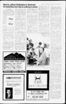
Show Lake County for 21 years; and returned to Blanding where he worked for the LDS Church for 14 years. He was later em- THE SAN JUAN RECORD Wednesday, February 26, 2003 - Page 16 GEORGE A. BLACK November 9, 1930 Beloved husband, father, grandfather and brother George A. Black, 72, passed away peacefully February 17, 2003 in Blanding, Utah after a - February 17, 2003 to everyone who met him; he was known as the miracle man for the last two years of his life due to this He loved gar- dening and his family took and great pride in No- both. He was vember 9, 1930 to Justin A. and Blanche C. faithful a member of LDS the Church and was a High Priest at the time of his Black. Married Glenna L. Cannon May 28, 1958 in the Salt Lake death. Temple. George was wonderful a indomi- table spirit. two year bout with cancer. Born Construction until illness forced him to ployed by example to all who knew him. Although his life held many trials, he was always a compassionate and loving man. His spirit was an inspiration He spoke Spanish as a second language and kept fluent in it all his life. He served a mission in the San AntonioTexas-Spanis- h Mission from 1955 to 1957. He was employed by Salt Public notice Tri-Hur- st retire. Forest roads 50106 (South Cottonwood), 50095 (Causeway), 500881 Elk Ridge), 50090 (Gooseberry Pasture Guard Station), 55154 (Duck Road) to 50178 (Deadman Point to the Horse Pasture Canyon Trailhead). Decommission Forest Roads 50094 (from jet. Of UC-- to the termini), 55148 (from jet. 55149 to termini), 55151, 55152, 55153 (from Redd's Pasture tojet 55154 ), 55155, 55156, 55157, and 55158 by placing signs, ripping and seeding of road surface and placement of barriers which may include large rocks, logs, berms andor gates and fences. The estimated number of miles is 2 7. Decommission unclassified roads (unauthorized) UC-1- . UC-2- , UC-3- , UC-4- , UC-5- , UC-9- . UC-1- Dead Goose Travel and Road Improvement Project Manti-LSal National Forest MoabMonticello Ranger District Forest Supervisor Elaine J. Zieroth signed a Decision Notice and Finding of No Significant Impact on January 15 2003 for the Dead Goose Travel and Road Improvement Project. The Dead Goose Travel and Road Improvement Project was originally analyzed in the Dead Goose Vegetation Treatment Project Environmental Assessment and its Decision Notice and Finding of No Significant Impact signed by Janette S. Kaiser. Forest Supervisor August 25, 1997. In her decision, she deferred making decisions on the proposed road improvements (graveling, curve widening, and turnout construction i and obliteration or closure of anv identified system 1991 Forest Travel Plan' roads or trails at that time. Her decision directed Purest personnel to continue working with interested publics regarding the proposed road improvements and changes to access allowed under the existing Forest Travel Plan. The project area is generally located in the Deadman Point, Gooseberry Guard Station, and the upper south Cottonwood drainage areas of North Elk Ridge. It is in portions of sections 11.12,13.14.15,21,22,23,24 and 25, T34.S..R 19E and sections 6,7,8,9,16,17, 18, 19,20, and 21, T34S K 20E., Salt Lake City meridian. I have decided to implement the Dead Goose Travel and Road Improvements as a combination of the original EA's Alternative 2 Proposed Action and Alternative 4 Preferred Alternative! with specific modifications It is estimated that this project will begin in the spring of 2003. It should be completed within 5 years subject to available funding. Summaries of travel and road improvements areas follows: Gravel, w ith minor curve widening and turnout construction on approximately 12.4 miles on Lake-Red- a He is survived by his wife, Glenna; daughter, Melanie (Bob) Callahan, sons Barton (Marie) Black and Brandon (Deborah) Black; eight grandchildren; sisters Grace Krebs and Marilyn Ehlers and broth- ers Sherman and Durant Black. He is preceded in death by his elder brother, Porter Black and elder sister, Ora B. Bloxham and granddaughter, Sara Nicole Black. A special thank you to the caregivers in San J uan County for all their support during the last days of Georges illness. We would also like to thank the many friends and relatives who gave of their time and encouraged George and his family during his illness. Funeral services were held at the Blanding Fifth Ward on Saturday, February 22, 2003. 6 1 feet to a corner, thence with a fence N 3 deg 08' 1 5 feet to the plant of beginning. W 5(i ; EXCEITINd therefrom all oil, gas and minerals Together with all the improvements now or hereafter erected on the property, and ail easements, appurtenances, and fixtures now or hereafter a part o! the property. The current beneficiary of the trust deed is Mortgage Electronic Registration Systems, Inc. and the record owners of the properly as of the recording of the notice of default are Lawrence W Jacobs and Sharon R. Jacobs Bidders must lender to the trustee a $5,000 00 deposit at the sale and the balance of the purchase In! low it ig the sale. Both price by 2 00 noon the day the deposit and tile ha!. nice must lie in the form of a wire transfer, cashiers check or certified funds payable to Lundberg & Associates ( ash payments are not accepted A trustees deed will be delivered to the successful bidder w it Inn three business days after receipt of the amount bid DA TED February 7, 2003 s Scott Lundberg. Trustee 3209 Smith Main. Salt Lake- City, UT 84 i8()l Ollier Hours 8 DO a in 263-- 100 a PH. (435 FAX i ' ( above-describe- feet si. The Trust Lands Administration will accept competing applications during the following period of time: From 8:00 A M. FRIDAY, FEBRUARY 21, 2003 Until 5:00 PM. RICHFIELD, UT 84701 Proposals and (Quotations w ill be opened at 2 00 p m March 4. 2003 at the Buildings & Grounds Office, 30 West 200 North, Blanding, Utah. San Juan School District reserves the right to accept or reject any proposal and (Quotation or any portion Pro)oal and (Quotation. Published February 12, 19 and 20, 200.3 in the San Juan Record. Monticello, Utah (8011 UC-1- UC-1- UC-2- lC-16- 8 d 896-649- Reference No.: SULA 1387 The Trust Lands Administration reserves the right to reject anv application or subsequent bids. Published February 26, March 5 and 12, 2003 in the Sail Juan Record, Monticello, Utah. fill) 5 p m I.&A Case No .10763 Team AJIIA THIS COMMUNICATION IS AN ATT KM IT TO COLLECT A DEBT. AND ANY INFORMA- LEX REALTY TION OBTAINED WILL BE USED LOR THAT PURPOSE Published I'Ybruury 12. 19 and 26. 2003 m the San Juan Recoid, Moiitncllu, Utah 5 ALES - - TITLE INSURANCE RENTALS PROPERTY MANAGEMENT 435-587-2- 424 FOR M0NTICEL10, BLANDING, BLUFF or fiporterlasal 1 beginning. Holli Public notice PARCEL 2 T29S, R24E, SLBM. Beginning at a point which hears N. 868 0 feet and W 101.9 feet from the closing corner of Sections 5 and 8 and proceeding the nce East 1379 0 feet, thence S. 560-- feet, thence W 1370 2 feet, thence N. 0 deg. 54' W. 588-- feet to the point ol beginning. In Sections 4 and 5, T29S, R24E, SLBM LESS the following described land Beginning at a point on the North line of Ferguson, said point bears West 79 0 feet, thence South 1557.4 feet, thence East 338.7 feet from the West 14 Corner Section 4, T29S, R24E, SLBM, and proceeding thence with the North line of Ferguson East 403 8 feet, thence South 560 7 feet, thence with the South line of Ferguson West 373 1 THK GRAM) WATKK & SKW'KK SKKVICK AGKNUY Oprnitmg Cummitln ;nul Board ( Directors hereby give notice their meetings sill he held on the following dotes. The meetings will In held at 7 00 p in at the District ollice, dOlL'i K Spanish Trail Rd , Moab, UT June 20, 2002 - Tax Hearing August 21, 2003 November (, 2003 - Tentative Budget December IS, 2003 - Budget Hearing The public is invited to attend and lie heard at all meetings. si Dale F RietMin Manager )pera tor Published Fe bruary 2(i and March f), 2003 in the San Juan Record, Monticello, Utah Public notice The County of San Juan is accepting Statements of Qualifications and Experience from qualified Airport Engineers for future projects at the Cal Black Memorial Airport. Services as outlined in FAA Advisory Circular 1505100-14C- , include engineering services for all phases of the project which may be multiple-gran- t funded The services to be provided will include project management, planning, design and construction inspection of all stages of said projects as they are initiated, as well as general consultation services of all project stages for the following projects: 1. Airport Master Plan Update 2 Widen Runway to 75 feet and Taxiway to 35 lift Relocate Runway Lights 4 Extend Runway and Taxiway by 1,000 feet "i Add New Kunwnv and Taxiway Lights i. Add Bank of Batteries to the Solar Electri- j i.il !. 1 urn "ill hr b I'ed on Tutors im lulling re cent experience in airport projects, reputation, responsiveness, background, capability to meet tile Countys needs, quality of previuus projects undertaken, and familiarity with the Cal Black Memorial Airport and FAA standards, regulations and protocol Following review of the .Statements of Qualifications received, the County may reduce tiie list of applicants to approximately three for oral discussion, or may select the consultant from information received The submitter shall make a good faith tu include DBE participation for any terms of work that the submitter must subcontract Six (6) copies of the Statements of Qualifications must be received no later than 4 00 PM , March 7. 2003. If you need additional information, contact Mr Rick Bailey, Administrative Assistant at 1435) 587-322- 3 Published February 19. 26 and March 5, 2003 in the- San Jjan Record, Monticello. Utah Porter 435-587-2- 369 MOAB: Georgia Hamblin - 205 5. email: 400 E - 435-259-58- . m 42 Associate Broker Broker financing. 11,000 sq. ft. 76.5 frontage. Three parcels of heavily wooded canyon area w yr. around creek. 96 89 acres whome $175,000 458 2 80 16 acres $125,000. 4579 3 3 40 acres $85,000. 458o 4 Charming brick home on Main Street. 3 br, ba with 2 car garage on .95 3. 1 full 1 acre. Price reduced to $78,000. 4776 5 Custom Log Home on golf course. 4 br. 3 5 b, 4000 sq. ft. inch unfinished bsmt. Views are unmatched. Call today for a private showing. $215,000. 3530 6. 3.59 acres on north end of town on Hwy frontage, zoned commercial. Seller financing available. $40,000. 4779 Price reduced on this horse property on 2 5 acres. 4 br, 2 ba home w2 car garage. S86.500. 4953 10. Build a home with a view on this 0 46 acre lot just south of the high 7. school $20,000. 4?57 11. 1920s brick home with lots of character. 3 br, ba, wood floors. Has recent updates. $79,000. 5145 14 Brick home in great neighborhood. 4 br. 3 ba with office and garage. New furnace, sprinkler system, 1 lots of storage. SI 25,000. 15. 3.97 acres animal rights. $45,000. 5072 Will 5071 in Monticello with BLUFF 12 bldg, lots in Cottonwood Mountain View RV Park 29 hookups, showerlaundry on spaces, 1.65 acres. $125,000. Additional homes and acreage available. 21. Cozy home on the range 10 min on East of Monticello. 2 br, 1 b. 16 acres. Tall shade trees, fenced, more acreage available. 3119 29. Duplex near the schools. 2 br, 2 b and 1 br, 1 b. Could be 3 br home. Reduced to S63.000. 4501 18. MONTICELLO 2 Commercial lot between Pioneer Pk and W. W. Pizza. Possible seller COUNTRY PROPERTY 10 acres borders National Forest towards Blue Mtn Seller may BI-- addition, comprising an entire block. Can be bought separately. BI-Business Opportunity Formerly Turquoise Restaurant - turn key. seats 45 and service station - 4 pumps, garage. Also. 3br, 2ba home to live y Bank BI-- Historic native stone home on .45 acre. 1 bd, 2 ba, loft. Renovations in 1985. New pole barn for RV parking. Only $149,000. 4502 L-- 3 Lots 9 acres each & 10 in Stewart Subd. lot. S25.000 for both. EQUAL HOUSING OPPORTUNITY BLANDING New listing. Currently 4 br, 2 ba, brick home. Formerly a duplex Please call Holli. $95,000. 507o 411 Cedar Circle cul de sac 3 br, 1 ba, wcarport. Fruit trees, fenced yard. S65.000. 5144 2 br, 1 ba cottage, at 193 S. 200 E. $45,000. Old charmer in Blanding 1152 sq. ft. 2 bed. 1 ba plus bsmt. 1 bdrm, ba trailer behind home, garage, on .41 acres. Reduced to $49,000. 51 36 1 2. One of the largest commercial lots in town. 2.28 acres. Reduced to S75.000 B-- B-- B-- B-- 1 B-- 3208 1 5 3. Extra large lot for a home or on 1st N & 1st E. 0 56 acres, zoned commercial. Reduced to $29,000 B-- LASAL sell wwater shares. in sell for only $250,000. will C-- divide. $50,000. 4890 C-10.56 acres just 4.4 miles east of Monticello on Hwy 666. Has wellwell house. $30,000. 4582 C-- 3 Hole in the Rock area 3 br, 2 ba home with private well on 1 acre $175,000. C-Long Canyon Estates, lots 12 & 13. Cty road towards Blue Mountain Guest Ranch. Oaks, pines. & privacy. S36.000 & $34,000. 4583 & 4s4 C-on Mustang Mesa. 5, 15 & 100 acre tracts Easy access, views of all 4 corners. C-53.64 acres with a home Partially woodedcleared, fully fenced for animals. 30 gpm well. 3 br. 1 ba trailer S80.460. 5127 , 1 lowing 45 days after publication in theSni Advocate newspaper. For additional information concerning this decision, please contact Don Carpenter at the Moab Monticello District Office, 496 East Central, P.O. Box 820, Monticello, UT 84535, telephone or Michael Davis (Environmental Coordinator), Supervisors Office, 599 West Price River Drive, Price, UT 84501, telephone Published February 26, 2003 in the San Juan Record, Monticello, Utah. MONDAY, MARCH 24, 2003 TRUST LANDS ADMINISTRATION 130 N MAIN 078-134- , water-barre- SECTION 32: SW4 WITHIN Containing 26.75 acres, more or less Any individual wishing to submit a competing application to purchase, lease, andor exchange for this property, a portion thereof, or a parcel including any of the acreage, should also file an application and the appropriate application (435)078-125- UC-1- l SLB&M DISTRICT will accept scaled Proposals and (Quotations for the following work until 2 00 p m. on March 4, 2003. - Steam Boiler replacement at Monticello Elementary School in Monticello, Utah - Roof replacement at Monument Valiev Stall Housing in Monument Valley, Utah. Roof replacement at the San Juan School District Office in Blanding, Utah. Requests for Plans and Specifications should hi' submitted to Jell Bailey Buddings & Grounds Department San Juan School District 30 West 200 North Blanding, Utah 84511 , 7 , The l.'tah School and Institutional Trust Lands Administration has received an application to lease the surface ol the following described acreage: SAN JlAN COUNTY TOWNSHIP 29 SOUTH. RANGE 21 EAST SAN JUAN SUHOOL UC-18- mately length is 1.5 miles. Realign the intersection of Forest road 50094 with 50088 closer to the southern tree line to avoid the wet areas in the meadow. Designate UC-6- , UC-and lC-- roads as classified roads as part of the Forest Transportation System. This will be an extension of Forest Road 50094 and designated as a levc-- 2 native surface high clearance roads. This route dissects a cattle allotment fence and a cattleguard will be required at this location prior to opening the route. The eastern portion (about 0.5 miles) of Motorized Trail 5445 will be decommissioned by ripping and seeding the trail running surface, barriers which may include large rocks, logs, berms and signed. Existing trail markers will be removed andor painted out. The trail will be realigned to follow the existing Forest Road 55203 alignment. A trailhead will be developed at it junction with KK 50094 and ER 50106 for parking. The estimated length of the new trail is 2.8 miles. The decommissioned portion of Forest Road 55155 to Horse Pasture Trail 5025 will he contrail and made a part of verted to a Trail 5025. Designate and convert Forest Road 55204 from a high clearance drive road to a motorized ATV trail. The road surface would be to provide for ripped, seeded and drainage and signed. The trail would be designed and constructed to meet Forest Service ATV trail specifications. The estimated length within the project area is 1.7 miles. This decision is subject to appeal pursuant to Forest Service regulations at 36 CFR 215.7. Any written appeal must be postmarked or received by the Appeal Deciding Officer within 45 days of the publication of this notice in the Sun Advocate newspaper, F'ebruary 13, 2003. The Appeal Deciding Officer is: Regional Forester, Intermountain Region, 324 25th Street, Ogden, Utah 84401. Appeals must meet the content requirements of 36 CFR 215.14. Implementation of this project may occur fol- Public notice NOTICE OF TRUSTER'S SALE Thr following dosmbcd property will be sold at public auction to the highest bidder, payable in lawful money of the United States, at the at the Main Entrance, San Juan County Public Safety Building, 297 South Mam Street, Monticello, Utah, on March 18,2003. at 12 00 p m of said day, for the purpose of foreclosing a trust deed originally executed on July 12, 1999 by Lawrence W. Jacobs and Sharon K. Jacobs, as trustors, in favor of First Security Bank, N.A , covering the follow ing real property purported to be located in San Juan County at 113 South Lisbon Road, Lasal, UT 84530 (the undersigned disclaims liability for any error m the address), and more particularly described as. PARCEL Beginning at a point on the North line of Ferguson, said point bears West 79 0 feel, thence South 1557 4 feet, t lienee East 338 7 feet from the Wist 14 corner. Section 1, T29S, K24E, SLBM, and proceeding thence with the North line of Ferguson East 403 8 feet, thence South 500 7 feet, thence with the South line of Ferguson Wist 373 feet to a fence corner, thence w ith a fence N 3 deg 08 W 561.5 feet to the point of beginning EXCEPTING therefrom all ml. g;m and minerals. TOGETHER with an access easement in the SW14 Section 4, and the KE14 Section 5, T29S, K24E, SLBM, San Juan County, Utah, more particularly described as lollows. Beginning at a corner at the NV corner ol Ferguson, said point hears West 79 0 fret, thence South 1557 4 feet from the West 14 corner. Section 4, T29S, K24E, SLUM, and proceeding thence with tile North line of Ferguson East 742 5 feet, thence South 20 0 feet, thence West 742 feet, thence North deg 06 W 2U 0 feet to the point ol UC-13- and UC-2by placing signs, ripping and seeding of road surface and placement of barriers which may include large rocks, logs, berms andor gates and fences The estimated number of miles is 8 1. For administrative use only (level lithe following Forest Roads 55201 and 55202. Approxi- City Cemetery. Public notice UC-1- UC-1lC-17- , Interment at the Blanding Public notice d 1 business 3209 |