| OCR Text |
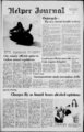
Show 4 The Helper Journal Wednesday, Feb. 26, 1975 Ordinance No. 460 AN ORDINANCE PROVIDING FOR THE SUBDIVISION, PLATTING AND IMPROVING OF ALL REAL. PROPERTY WITH HELPER CITY, UTAH: REPEALING ALL ORDINANCES IN CONFLICT HEREWITH AND PROVIDING PENALTIES FOR THE VIOLATION THEREOF: WHEREAS, a Planning Commission has been appointed for Helper City; and WHEREAS, said Planning Commission has adopted a Major Street Plan; and WHEREAS, said Major Street Plan has been certified to the City Council; and WHEREAS, said Planning Commission is charged with the responsibility for preparing regulations for the subdivision of land within the city and recommending said regulations for adoption by the City Council: and WHEREAS, said Planning Commission and City Council are charged with the duty of reviewing and approving all subdivision plats in accordance with such regulation, before such plats are recorder; now therefore, BE IT ORDAINED BY THE CITY COUNCIL OF HELPER CITY, UTAH AS FOLLOWS: 03.0100 TITLE AND PURPOSE This Ordinance shall be entitled the "Subdivision Ordinance of Helper City" and may be so cited and pleaded. The purpose of this Ordinance shall be to promote the health, safety, convenience and general welfare of the present and future inhabitants of the city; to facilitate the orderly development of the city and to establish the rights, duties and responsibilities of subdividers with respect to the subdivision of land. 03.0200 LAND SHALL BE SUBDIVIDED BEFORE RECORDING v From the effective date of this ordinance no person shall subdivide any tract of land which is located wholly or in part within the limits of Helper City, Utah, nor shall any person sell, exchange, or offer for sale, or purchase, or offer to purchase any parcel of land which is any part of a subdivision of a larger tract of land within the City,nor shall any person offer for recording any deed conveying such a parcel of land or any interest therein unless he shall first make or cause to have made a final plat thereof which plat shall be in accordance with all of the requirements of this Ordinance and shall have been approved by the Planning Commission and City Council and recorded in the Office of the County Recorder. Provided, however, that land may be sold by metes and bounds without the necessity of recording a final plat if all the following conditions are met: (a) the subdivision contains less than ten (10) lots; (b) the subdivision layout plant, complying with the requirements for a preliminary plan as set forth in this ordinance, shall have been first approved in writing by the Planning Commission; (c) the subdivision is not traversed by the mapped lines of a proposed street as shown on the official map or maps of the municipality; (d) the subdivision does not require the dedication of any land for street or other public purposes; (e) each lot in the subdivision meets the frontage width and area requirements of the Zoning Ordinance or has been granted a variance from such requirements by the Board of Adjustment; and (f) all improvements required under Section 03.0600 of this ordinance shall have been installed or assurances given to the city that said required improvements will be installed without cost to the city as provided for in Section 03.0800 of this ordinance. 03.0300 PROCEDURE FOR OBTAINING APPROVAL OF A SUBDIVISION 03.0301 Discuss Proposed Subdivision with Planning and Zoning Administrator. Any person wishing to subdivide land within the city shall secure from the Zoning Administrator information pertaining to the city's plan of streets, parks drainage, zoning and other Master Plan requirements affecting the land to be subdivided. 03.0302 Prepare Vicinity Plan. The subdivider shall then prepare a Vicinity Plan and shall submit Ucc (3) copies of the same to the Planning Commission not less than seven (7) days prior to the next regularly scheduled Planning Commission meeting. 03.0303 Obtain Planning Commission Approval of Vicinity Plan. The Planning Commission shall review the vicinity plan and shall approve or disapprove the plan of the subdivision or approve it subject to required modifications and-o- r conditions within thirty-on- e (31) days from the date of submission to the Planning Commission. Failure of the Planning Commission to act within the specified time shall constitute a finding of approval. Approval of the vicinity plan shall not be construed to constitute approval of the subdivision but shall be deemed as an expression of approval of the basic concept and general layout of the proposed subdivision which the subdivider may use as a guide in the preparation of the preliminary plan. 03.0304 Prepare Preliminary Plan and Engineering Drawings. Upon approval of the Vicinity Plan by the Planning Commission the subdivider shall prepare a preliminary plan of the subdivision and shall submit three (3) copies of the same to the Planning Commission not less than seven (7) days prior to the next regularly scheduled Planning Commission meeting. Said plan shall contain: A. A layout plan(s). B. Preliminary Engineering Drawings. C. Any other material or information required by the Planning Commission. Said Preliminary Plan shall show all data and material required for Preliminary Plans as set forth under Section 03.0402 of this Ordinance. The Vicinity Plan and the Preliminary Plan and engineering drawings may be submitted to the Planning Commission for its consideration at the same time. 03.0305 Obtain Planning Commission Approval of Preliminary Plan. The Planning Commission shall review and shall approve or disapprove the Preliminary Plan, or approve it with modifications within thirty one (31) days from the date of the submission of the Preliminary Plan to it. Approval or denial of the plan shall be based upon compliance with the Master Plan and with the standards and conditions of approval, as set forth herein. The action of the Planning Commission shall be written on the face of two copies of the Plan; one of which shall be retained in the files of the Planning Commission, and one of which shall be returned to the subdivider. If disapproved, the Planning Commission shall express its reasons therefor to the subdivider. Failure of the Planning Commission to act upon the Preliminary Plan within the time specified shall be construed as to constitute approval of the basic subdivision layout only. Such approval through inaction of the Planning Commission shall not exempt the plan or the subdivider from compliance with all other procedures, standards, specifications, and requirements for subdivisions adopted as part of or pursuant to this ordinance. Where a subdivider owns or controls more land than he wishes to develop immediately, the Planning Commission may require that a preliminary plan of the whole area be submitted, in which case the subdivider shall indicate on the preliminary plan the portion to be developed immediately and the portion to be held for future development. Whenever final approval has been obtained on any part of an approved preliminary plan, approval of the remaining part of said preliminary plan shall remain in effect for a period of two years. The preliminary plan for subdivisions not requiring the preparation and approval of a final plat or its recording in the office of the county recorder shall not be approved by the planning Commission until assurance, satisfactory to the commission, has been received that all other requirements of this ordinance have been compiled with. -- (See 03.0308-B)- . Prepare and Submit Final Plat to Planning After the preliminary plan has been approved, the subdivider shall then prepare and submit one (1) tracing and two (2) copies of the final plat of the subdivision to the Planning Commission. 03.0307 Obtain Planning Commission Approval of Final Plat. The Planning Commission shall review the final plat and shall approve or disapprove the final plat and approve it with modification, within 45 days of submission. If 03.0306 Commission. disapproved, the Planning Commission shall state its reasons therefore to the subdivider. 03.0308 Post Performance Guarantee. A. Subdivisions requiring final plat After approval of the final plat of a subdivision by the planning commission, the subdivider shall either construct required improvements or post a bond or other assurance with the city clerk in an amount, as determined by the city engineer sufficient to cover the costs of any improvements required under this ordinance as a guarantee that said improvements will be installed and paid for without cost to the city. B. Subdivisions not requiring a final plat Prior to the approval of the preliminary plan by the planning commission, the subdivider shall post a bond or other assurance with the city clerk in an amount, as determined by the city engineer, sufficient to cover the costs of installing any improvements required under this ordinance, as a guarantee that said improvements will be installed and paid for without cost to the city. 03.0309 Obtain Approval of City Council. After posting bond or other assurance the final plat shall be submitted to the City Council for approval. Unless otherwise provided on the plat, approval of the final plat by the City Council shall constitute the acceptance by the city of all streets and other properties dedicated for public use. 03.0310 Record Final Plat. After obtaining approval of the City Council, the subdivider shall submit the final plat tracing to the office of the county recorder for recording, within 90 days of the date of approval by the City' Council. 03.0400 PLATTING AND RECORDING REQUIREMENTS 03.0401 Vicinity Plan. The Vicinity Plan shall show a simple sketch drawn to scale of the proposed layout of streets, lots, and other features, in relation to existing and mile of the subdivision. planned streets within The plan may be a pencil sketch or may be made directly on an aerial photograph. The plan shall be prepared at a scale of not smaller than one inch equals 500 feet. 03.0402 Preliminary Plan. The Preliminary Plan shall be drawn to a scale of one inch equals 100 feet or larger and shall show: A. The proposed name of the subdivision. B. The location of the subdivision as forming a part of a larger tract or parcel where the plan submitted covers only a part of the subdivider's tract. C. Sufficient information to locate accurately the property shown on the plan including all land subdivision movements and land subdivision lines as established by the U.S. Government. D. The names and addresses of the subdivider, the engineer or surveyor of the subdivision, and the owner of the land immediately adjoining the land to be subdivided. E. Contour map at appropriate intervals where required by the Planning Commission. F. The boundary lines of the tract to be subdivided. G. The location, width, and other dimensions of all existing or platted streets and other important features such as water courses; exceptional topography, and buildings within the tract and within two hundred (200) feet of the tract to be subdivided. H. Existing sanitary sewers, storm drains, water supply mains, and bridges within the tract, or within two hundred (200) feet thereof. I. The location, width and other dimensions of proposed streets, alleys, easements, parks and other open spaces, with proper labeling of spaces to be dedicated to the public or to be reserved for common use and benefit of development residents. J. North Point, Scale and Date. K. Preliminary Engineering Drawings and Plans inone-four- th cluding: 1. Typical cross sections and plans for all types of proposed streets. 2. Location (both and off site) size and type of proposed water mains, sanitary ewers or other sewage disposal facilities, and all othe proposed improvements such as sidewalks, curbs, gutters, parks and open space areas, fire hydrants, and streetlights. 3. Location of all drainage and flood control facilities and provisions for elimination of environmental hazards. L. Adequate assurance that the subdivider has a good and marketable title to the land proposed for subdivision. Such assurance shall be in the form of a policy of title insurance or an attorneys title opinion. M. Any other data, material, or plan as may be required by the Planning Commission. 03.0403 Final Plat. The final plat shall be prepared on a sheet of approved tracing linen or mylar to the outside or (36) trim line dimension of twenty-fou- r (24) by thirty-siinches and the border line of the plat shall be drawn in heavy lines, leaving a space of at least one and side of the sheet for (IV2) inches margin on the (V2) inch margin in binding, and not less than from the outside or trim line around the other three sides or edges of the sheet. The plat shall be so drawn that the top of the sheet either faces North or West, whichever accommodates the drawings best. All lines, dimensions and markings shall be made with approved waterproof black "India Drawing Ink," or equivalent. The actual map shall be made on a scale large enough to clearly show all details, and the workmanship on finsihed drawings shall be neat, clean cut and readable. The subdivider shall also furnish the Planning Commission with two (2) prints of the final plat when submitting the tracing. The final drawings or plats shall contain the following information: A. Subdivision name and the general location of the on-sit- e -- x one-ha- left-han- lf d one-ha- lf subdivision. B. A north point and scale on the drawings and the date. C. Accurately drawn boundaries, showing the proper bearing and dimensions of all boundary lines of the subdivision, properly tied to public survey monuments. These lines should be slightly heavier than street and lot lines. All dimensions and calculations shall show proper closure in all boundaries of the subdivision, and no plat will be accepted that shows a plus or minus distance for closure of less than 1 in 10,000, unless agreed by the Planning Commission or other person duly empowered by resolution. D. The names, widths, lengths, bearings and curve data on proposed public streets, alleys, easements; also the boundaries, bearings and dimensions of all portions within the subdivision, as intended to be dedicated to the use of the public; the lines, dimensions, bearings, and numbers of all lots, blocks and parts reserved for any reason within the subdivision. All lots and blocks are to be numbered consecutively under a definite system approved by the Planning Commission. All proposed streets shall be named or numbered in accordance with and in conformity with the city's street naming and numbering system. E. The location of all required monuments. F. The description and locations of all monuments set and established by the County or the United States Governments that are adjacent or near this proposed subdivision. The standard forms approved by the Planning Commission lettered for the following: 1. Description of land to be included in subdivision. 2. Registered Land Surveyor's 'Certificate of Survey'. 3. Owner's dedication. 4. Notary Public's Acknowledgment of Dedication. 5. Planning Commission's Certificate of Approval. 6. City Engineer's Certificate of Approval. 7. Approval of Public Health Official, including notation of any special requirements. 8. The City Council's Certificate of Acceptance and G. Approval. ' 03.0-10- Recording Requirements. Final plats must be recorded in the office of the County Recorder not less than ninety (90) days from the date of approval of the final plat by the city council, and no lot shall be sold within such subdivision until the plat has been so approved and recorded. A final plat of any subdivision which is not recorded within ninety (90) days from the date of approval by the city council shall be null and void, unless a longer period of time is approved by the city council. Approval of the final plat by the Planning Commission shall not be deemed as the acceptance of the dedication of any street, public way, or ground. Such acceptance shall be obtained from the city council. 03.0500 DESIGN STANDARDS AND REQUIREMENTS 03.0600 IMPROVEMENT REQUIREMENTS in all subdivisions in Improvements shall be installed accordance with standards and requirements hereinafter set forth, provided, however, that actual construction of subdivision may be delayed required 'improvements in the bond or other assurance suitable a Where two to years. up as provided for subdivider the is furnished to the city by elsewhere in this ordinance. (See particularly Sections 03.0308 and 03.0800 to 03.0804). Said improvements shall be as follows: 03.0601 Streets and Travel Easements. All streets and travel easements shall be graded and paved and culverts installed in accordance with city standards as directed by the City Engineer. " 03.0602 Sewer Mains and Sewage Disposal. Both sewer mains of not less than eight (8) " and inches in diameter shall be installed in such a way that each lot may be served therefrom. " " and water 03.0603 Water Mains. Both in inches diameter shall be six than (6) mains of not less installed in such a way that each lot can be served therefrom. 03.0604 Curb and Gutters. Curb and gutters shall be constructed in accordance with City standards as directed 03.0501 Minimum Area of Subdivision. There shall be no minimum area for a subdivision except as required to meet the minimum lot size and requirements as provided in the Zoning Ordinance for the area in which the subdivision is located. and 03.0502. Streets and Alley Widths, Easements. A. Street Widths. Major and collector streets shall conform to the width assigned on the Master Street Plan wherever a subdivision falls in an area for which a Master Street Plan has been adopted. Where a Master Street Plan has not been completed at the time the Preliminary Plan is submitted to the Planning Commission, streets shall be provided as follows: 1. Residential streets shall have a minimum width of fifty (50) feet. 2. Collector streets shall have a minimum width of sixty-si- x (66) feet. 3. Secondary arterial streets shall have a minimum width of eighty-twand " (82.5) feet, or as shown on by the the Master Plan, whichever is greater. in conventional subSidewalks Sidewalks. 03.0605 4. Minimum width of roadway wherever curb and (3M) feet wide and be three and shall divisions gutters are installed (face to face of curb) shall be as shall be constructed in accordance with City standards as follows: directed by the City Engineer. For residential streets 37 feet. 03.0606 Fie Hydrants. Fire hydrants shall be installed in 44 feet. For collector Streets with city specifications. accordance For secondary arterial streets 60 feet, or conform to 03.0607 Permanent Monuments. Permanent monuments Master Street Plan, whichever is greater. in accordance with city specifications. B. Alleys. Alleys shall have a minimum width of twenty shall be installed 03.0608 Underground Utilities. Electric and telephone (20) feet. Alleys may be required in the rear of business be located underground except when the shall lines lots, but will not be accepted in residential blocks except show the Planning Commission that uncan under unusual conditions where such alleys are considered are not feasible. lines derground necessary by the Planning Commission. Hazards. Environmental hazards Environmental 03.0609 C. Reverse Curves". Reverse curves shall have a tangent as be eliminated must required by the Planning Comof at least one hundred (100) feet, unless in the opinion of follows: as mission the Planning Commission such as not necessary. A. No cut or fill slopes shall be constructed in a location D. Street Intersection. Streets shall intersect each other in such a manner which produces a slope face exceeding or as near as possible at right angles. Minor streets shall critical angle of repose unless, in the opinion of the the not approach the major or collector streets at an angle of less than eighty (80) degrees. Offsets in street alignment of Planning Commission, adequate measures will be taken to more than ten (10) feet or less than one hundred twenty prevent the soil from moving under force of gravity until such slope is stabilized. All cut and fill slopes shall be (120) feet shall be prohibited. E. Street Grades. Minimum street grades of 0.6 per cent covered with top soil and reseeded to the same extent as the will be required with the maximum grade being 7 per cent prior existing natural conditions unless, in the opinion of for collector streets aid 10 per cent for minor streets. the Planning Commission, alternative or additional Where the observance of this standard is unfeasible, the treatment of the slope is necessary to avoid the creation of Planning Commission shall have the power to grant an a significant soil erosion, flood or other environmental exception when special pavement surfaces and adequate hazard. B. Location of streets and buildings on unstable soil shall leveling areas are installed or in the opinion of the Planning Commission the best subdivision of the land is thereby be avoided. C. Surface water produced from the subdivision secured. F. Street Curves. Where the street lines within a block development shall be properly disposed within the subdeflect from each other at any one point more than 10 (10) division or shall be drained into natural channels in a degrees, there should be a connecting curve. The radius of manner that will reduce the exposure to flood hazard and the curve for the inner street line should be not less than 350 will prevent the soil within and outside of the subdivision feet for major streets, 250 feet for an important neigh- from eroding, and will not produce an undue flood hazard to borhood street, and 100 feet for minor streets. adjacent properties. D. The subdivision layout shall make adequate provision G. Curbs. Curbs at all intersections shall be rounded with curves having a minimum radius of 15 feet for minor for natural drainage channels and floodways. E. All water, sewer, and other utility systems and streets and 25 feet for collector and major streets. Property lines at street intersections should be rounded with a curve facilities located in flood hazard areas shall be designed to minimize infiltration of flood water into the system, or where necessary to fit the curb radius. H. Street names. New street names should not duplicate discharge of the system into the flood waters. F. Other environmental hazards must also be eliminated those already existing. A street obviously a continuation of another already in existance should bear the same name. or adequately handled as directed by the Planning ComBefore the street is named, the proposed name must be mission. 03.0610 Street Lights. Street lights shall be installed in submitted to and approved by the Planning Commission. I. Street Dedications. All streets shall be dedicated for accordance with city specifications. 03.0700 COSTS AND CHARGES IN public use. The dedication of half streets in any subdivision is prohibited, except on the borders. CONNECTION WITH THE DEVELOPMENT J. Relations to Adjoining Street System. The OF SUBDIVISIONS Costs and charges in connection with the planning and arrangement of streets in new subdivisions shall make provision for the continuation of the existing streets in development of subdivisions shall be shared between the adjoining areas (or their proper projection where adjoining subdivider and the city according to the following land is not subdivided) at the same or greater width (but in schedule: no case less than the required minimum width) unless Plan or Facility Subdivider City variation are deemed necessary by the Planning Com- 1. Vicinity Plan 0 per cent per cent mission, insofar as such may be deemed necessary by the 2. Preliminary and must Subdivider pay plan 0 per cent plan Planning Commission, for public requirements. The street engineering drawings checking fee to me city of $2.00 per acre up to 20 acres, arrangement must be such as to cause no unnecessary plus $1.00 for each hardship to owners of adjoining property when they plat ditional acre in preliminary their own land and seek to provide for convenient access to plan. it. Where, in the opinion of the Planning Commission, it is 3. Final Plat Subdivider must pay plat 0 per cent desirable to provide for street access to adjoining property, checking fee to the city of $25.00, plus $2.00 per lot. proposed streets shall be extended by dedication to the 100 r cent 0 per cent 4. Easements and boundary of such property. and "off site" K. (dead end streets) shall be way used only where unusual conditions exist which make other 5. Grading and draining 100 per cent for all minor Si'"1 negotiations with City Council for all grading and collector streets. shall- have a streets and drainage work over designs undesirable. Each estimated costs of minor width of fifty (50) feet and must be minimum and collector streets. terminated by a turn around of not less than one hundred t. Grading Special and in Surface must water diameter. drain feet Negotiations with (100) draining away Special negotiations City streets the City Council. Council. from the except that where surface water cannot be drained away from along the street, 7. Bridges and Culverts 100 per cent for all minor Special negotiations with due to grade, necessary catch basins and drainage streets and collector streets. City Council for the costs of bridges and culverts In easements shall be provided. excess of the cost of such L. Easements. Where alleys are not provided, easements facilities required for miner and collector streets. of not less than five (5) feet on each side of all rear lot lines 100 percent for all minor a. Street paving Special negotiations with and side lines will be required where necessary for poles, streets and for collector and City Council for the cost of to streets storm 44' arterial or of up wire, conduits, paving in excess of 44' of sanitary sewers, gas and water pavement width. pavement width when such mains, and other public utilities. Easements of greater extra width Is required by width may be required along property lines where the city. necessary for surface overflow or for the extension of main 9. Curb and gutter and curb '00 per cent 0 per cent sewers or similar utilities. cuts s, "off-site- "on-site- "on-site- "off-site- o one-ha- lf one-ha- lf sub-divid- er 100 ad- rights-of- - Cul-de-sa- s. cul-de-s- - right-of-wa- y turn-aroun- d, turn-aroun- d 03.0503 Blocks. A. Length. The maximum length of blocks, generally, shall be thirteen hundred (1,300) feet and the minimum leneth of blocks shall be four hundred (400) feet. In blocks over eight hundred (800) feet in length, the subdivider may be required to dedicate a walkway through the block at approximately the center of the block. Such walkway shall not be less than ten ( 10) feet in width. B. Width. The width of blocks generally shall be sufficient to allow two (2) tiers of lots. C. Use. Blocks intended for business or industrial use shall be designed especially for such purposes with adequate space set aside for parking and delivery facilities. 10. Sidwalk 100 percent 0 per cent 11. Street signs 100 per cent 0 per cent 12. Water supply 0 13. Water mains 100 per cent for all water Special negotiations with mains and laterals up to and the City Council for 6" dlamter. fere nee between cost of " line and that which Is required by the city. 14. Sewer mains 100 per cent for all sewer Special negotiations with mains and laterals up to and ne City Council for 8" diameter. fere nee between cost ot 8" line and that which Is required by the city. 15. Street lighting off-stre- et 03.0504 Lots. A. Building Sites. The lot arrangements, design, and shape shall be such that lots will provide satisfactory and desirable sites for buildings and be properly related to topography and conform to requirements set forth herein. Lots shall not contain peculiarly shaped elongations solely to provide necessary square footage which would be unusable for normal purposes. B. Lot Sizes. All lots shown on the subdivision plat must conform to the minimum requirements of the Zoning Ordinance for the zone in which the subdivision is located. C. Lots Must Abut on Public Streets. Each lot shall abut on a street dedicated by the subdivision plat or an existing publicly dedicated street, or on a street which has become public by right of use and is more than fifty (50) feet wide. Interior lots having frontage on two streets shall be prohibited, except where topographic conditions make such design desirable. D. Corner Lots. Corner lots shall have extra width sufficient for maintenance of required building lines on both streets. E. Angle of Lots. Side lines of lots shall be approximately at right angles, or radial to the street line, except where topographic conditions make it advisable to have side lot lines deflect at sharper angles. F. Parts of Lots. All remnants of lots below minimum size left over after subdividing of a larger tract must be attached to adjacent lots rather than allowed to remain as unusuable parcels. G. Divided Lots. Whore the land covered by a subdivision includes two or more parcels in separate ownership and the lot arrangement is such that a property ownership line divides one or more lots, the land in each lot so divided shall be transferred by deed to single ownership before approval of the final plat, and such transfer recorded in the County Recorder's office before being certified to the Planning Commission by the subdivider. per cent 100 per cent lor easements and of facilities. rights-of-wa- stallation 14. Electric utilities 100 17. Parks 0 Monuments 100 18. 100 in- - per cent '00 per cent for main-antenance ol lights alter in- stallation. per cent 0 per cent except per cent 100 per cent 0 per cent per cent Canal and flood Channel protection Special negotiations city Council. with 20. Elimination of other environmental hazards rWil. noo,'lo with Special 19. Special negotiations with city Council. negotiations with aty couni. 03.0800 GUARANTEE OF PERFORMANCE 03.0801 Type and Amount of Guarantee. The type of performance guarantee submitted by the subdivider shall be in the form of a (1) cash deposit, (2) bond, or (3) mor- tgage, executed in the favor of the city on real property which is unrelated to the The amount of proposed the guarantee shall be in an amountproject. or value equal to the cost of the required improvements 03.0802 Duration. The duration of the bond or other assurance shall be for two years from the date of approval of the subdivision by the City Council. An extension of time may be granted by the City Council upon application by the subdivider, provided such application is submitted at least sixty (60) days prior to the expiration of the bond, and provided the issuer of the bond is willing to extend the time of the assurance The City Council may upon appeal of the subdivider grant a limited extension of the time limit, not to exceed ninety (90) days, without the necessity of filing the sixty (60) day notice as required above, when it is determined by the City Council that failure to perform is due to conditions beyond the control of the subdivider. 03.0803 Default. In fiie event'the subdivider is in default or fails or neglects to im- satisfactorily install the required |