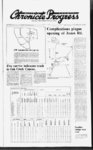
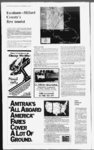
| Show Page 10 Millard County LSPS Thurs Nov 15 1984 Escalante--- E County’s first tourist Editors note: In the fall of 1776 Franciscan Fathers Francisco Atanasio Dominguez and Silvestre Velez de Escalante passed through Millard County midway through an expedition to establish an overland route between Santa Fe New Mexico and Monterey California The exploration was one of the most ambitious endeavors in the history of the Spanish American West Detailed records and maps left by the party of ten horsemen led by the enthusiastic priests give modern man the best picture of what the land and its peoples were like before it was settled by eastern immigrants The following is taken from Frank Beckwith’s writings about the exploration through Millard County During this part of the expedition the idea of pushing on to California was abandoned by the explorers The first mention of what was later to become Millard County was made by Father Escalante who passed through here in 1776 and made interesting entries in his diary at the time He was the first white man of record to set foot upon the Sevier Desert when he and his little party traversed a major portion of it while trying to find a new route between New Mexico and California According to a map and report Escalante made to Spain in 1777 the route taken through Millard County by the explorer is roughly this: Enjoy R Full Season Of M2Gijp TTOraMlsfi South to the Sevier After leaving Lake Timpanogos (Utah Lake) Escalante went southward coming to the Sevier River (which he named Santa Isabel) rather suddenly for no trees marked its path there and until one comes close to the river its presence is not known This was somewhere near the present town of Mills north of Yuba Lake From erroneous information from his Indian guides he was told the river he was then upon was the same river he had crossed near Jensen (The Green River) and consequently his map maker shows the Green River flowing and is designated the Santa Isabel whereas the Sevier River southeastwardly flows north to a short distance beyond Mills makes a hairpin turn past Leamington and then meanders through a portion of the Sevier Desert emptying in its time and once again recently into Sevier Lake This is the only major mistake on Escalante’s map and his diary shows that he got his information from the Indian guides piloting the party Entering Millard County Escalante entered Millard County northwest of Scipio traversed that valley in the southward over Scipio Pass and on to a camping place approximately location of Fillmore where he camped and turned off west somewhere near Church springs He then northwest of Holden This was his last place of getting drinking water Escalante’s map shows that he passed the north face of Pahvant Butte from a distance of a few miles and his diary tells that he sent two men forward near nightfall to get water he had met bearded Indians who told him that two villages of Indians were camped nearer the river These camps the map maker shows as two pair of tipis near the river bank He passed westward to what is now known as in the lower Deseret region and there camped He shows Laguna de Miera (Sevier Lake) plainly which he named in honor of his map maker don Pedro Miera A minor error in his map is to show the House Range of mountains as very near the position of the Sevier River whereas in fact a number of miles separates them He shows Sevier Lake and Clear Lake as one continuous body of water this may be due to two things: Many deceptive mirages occur on the Sevier Desert and from the position of his camp there were at his time innumerable playa lakes as no water from the stream was then diverted for irrigation as is now the condition hence there was an abundance of water and this abundance of real water with the deceptive mirages of the unreal water led him to believe that Clear Lake and Sevier Lake were one continuous body of water a condition that a study of the region fails to bear out with any possible height of water in the Scvui River South from Pahvant Butte He broke camp after the second stop and passed between Pahvant Butte and Clear Lake Pahvant Butte he shows as an isolated abrupt dominating landmark on the great plain which it is In this prominent feature his map is highly accurate He names the big plain Valle Solado the Valley of Salt a term most apt as today colloquially we dub the region “The Big Alkali Flat” He shows Beaver Creek flowing northward from Santa Brigida (about the position of Milford) and ending on the desert just below Clear Lake Old settlers here remember when it actually flowed (a tiny stream) west into Sevier River but never did it empty into Clear Lake from any information I can get He shows a rather prominent stream (Rio Salado) flowing into Clear Lake from the southeast such a stream cannot be identified today as Wild Goose Creek Pioneer Creek Chalk Creek and Corn Creek all disappear in the desert and search over the area fails to show an ancient stream bed His next camping place (Arroyo Texedor) is probably to be identified as the fine spring in the lava near Black Rock Station on the Union Pacific RR line Some ancient petroglyphs are incised on the rocks there Passing southward he camped at Vegas Del Puerto which may be identified as being the place where the boy and his father quarreled (as stated in detail in his diary) and one of the Indian guides thinking blood would be shed deserted summarily CUSTOM HAULING Residential & Commercial To & From - Anywhere Anytime Have 1985 Ford Diesel wCustom made 20' Bed Experienced in all kinds of hauling New Mount Holly PO Box SI1 Bex per Utah 8471J Telephone (801) Mills Investment (Ed Mills) 864-309- 1 He then passed out of the region of the Sevier Desert and at Santa Brigida he is near Milford where Beaver Creek had turned from its course and flows northward into the Sevier Desert Those in possession of the land The Sevier Desert region has long been the habitation of Indians both in historic and times and evidences of that habitation are attested in several collections of metates manos arrowheads and other Indian artifacts found in the last two decades by the whites Ancient house remains were found at Kanosh by Dr Julian H Steward (see Early Inhabitants of Western Utah bulletin University of Utah) and Judd mentions Indian occupation in Bulletin 82 Bureau of American Ethnology Gilbert gives the geology of the region in a government monograph Lake Bonneville The Cricket Mountains are accurately shown as lying between Sevier Lake and Beaver Creek Winter equipment storage The weather has served notice that it is time for some farmers to consider storing their equipment for winter Dr Von Jarrett Extension Thanks to Amtrak’s “Ail Aboard America” fares you can have the time of your life vacationing aboard our trains You’ll get everything we’ve got Friendly helpful service Wide reclining seats Modern equipment Beautiful lounge cars Full service dining cars Snack bars And best of all you won’t have to give up much of what you’ve got If you buy a ticket before May 31 1985 you can travel to any city in one of our three regions for only $150 or less Any city in an adjoining region is only $250 or less Kids under Or go from coast to coast for only $325 round-tri12 get 50 off these already low fares You have 30 days to complete your travel as long as you return no later than June 30 1985 No advance purchase is necessary And you get one stopover each way Certain other restrictions may apply and seats are limited So now’s the time to get on board Plan now to enjoy the unique experience of train travel Over 19 million people ride with us every year— and discover that Amtrak is one of the most modern efficient and comfortable passenger train systems in the world For reservations or more information about our convenient schedules call your travel agent or Amtrak at agricultural engineer at Utah State offers the following University checklist to prepare machinery for its annual winter retirement: First all thoroughly clean machinery inside and out by removing soil sludge oil grain fertilizer and the like Steam cleaning is an indulgence that any good tractor would appreciate Lubricate according to diagrams in the operator’s manual and coat exposed metal surfaces with grease or corrosion inhibitor Drain the cooling system and flush with rust preventative Drain the oil and replace with new oil and filter Also drain and refill the transmission differential and hydraulic systems Drain the gasoline from gasoline engines and run the engine until the carburetor is dry Where diesel is used add a corrosion inhibitor Once everything has been pt the and clean all belts conveyors and batteries Store in these a clean dry place making sure you keep the battery off the concrete Finally store the machinery in a clean dry place away from livestock and poultry Where storage facilities are lacking cover the equipment with a tarp or plastic and be sure that rubber is not exposed to the sunlight Support machinery with blocks to take the load off the tires and call it a day with a load off your mind |