| OCR Text |
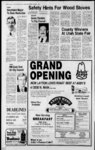
Show I WEEKLY REFLEX I I DAVIS NEWS JOURNAL, NORTH DAVIS LEADER, OCTOBER 1, 1981 dian, which point is North 0 degrees 0830 East 1313.51 and South 89 degrees 4312 East feet.(LC bears degrees 3735 West 153.50 feet); Southwest corner of The following applications have been filed with the State Engineer to appropriate water in Davis County throughout the entire year unless otherwise designated. Locations in SLB&M. 56558 David L. Smith, 1034 N. 2600 W Clinton, UT 0.015 sec. ft. of water is to be diverted from a 0 ft. deep, at a well, points. 1410ft. W. 400 ft. from N' Cor. Sec. 33, T5N, R2W (near Clinton); and used for the domestic purposes of family, stockwatering 4 cattle; and from Apr. to Oct. 31 for the irrigation of 0.25 acs. in thence South 69 degrees West 1227.93 200-70- 1 1 SE'iN W' Sec. 33, T5N, R2W. 56575 Leonard O. and Ermine N. Duffin, 743 W. 2300 N.. Clinton, UT 0.015 sec. ft. of water is to be diverted from drain water ditch, at a point N. 1287 ft. W. 58 ft. from NW Cor. Sec. 26, T5N, R2W (Clinton); and used from Apr. to Oct. 31 for the supplemental irrigation of 0.25 acs. in NW'ANW'A Sec. 26, T5N, R2W. 56576 Carol K. Child, 811 W. 2300 N Clinton, UT 0.015 sec. ft. of water is to be diverted from drain water ditch, at a point E. 1014 ft. from NW Cor. Sec. 26, T5N, R2W (Clinton); and used from Apr. 1 to Oct. 31 for the supplemental irrigation of 0.25 acs. in NW'.NW'A Sec. 26, T5N, R2W. 56579 Marlin V. Huff, 325 N. 2000 W West Point, UT 0.015 sec. ft. of water is to be diverted from a 1 ft. deep, at a well, point N. 138 ft. W. 120 ft. from SE Cor. Sec. 33, T5N, R2W (near West Point); and used from Apr. to Oct. 31 for the supplemental irrigation of 0.25 acs. in SE'ASE'A Sec. 33, T5N, R2W. 56725 Billy B. Dunbar, Box 9852, Ogden, UT 0.03 sec. ft. of water is to be diverted from a well, 150 ft. deep, at a point N. 750 ft. E. 400 ft. from S' Cor. Sec. 30, T5N, R2W (1 mi SE of Hooper); and used for stockwatering 10 cattle; and from Apr. 1 to Oct. 31 for the irrigation of 0.5 acs. in SW'tSE'A--Sec- . r 30, T5N, R2W, Protests resisting the granting of these applications with reasons therefore must be filed in duplicate with the State Engineer, 1636 W. North Temple, SLC, UT 84116, on or before Nov. 7, 1981. from the Southeast cor- Layton, and running . 1 . By Gordon Gurr Its Owner and Sole Proprietor NOTICE OF J TRUSTEES SALE The following described property auction to the highest bidder on the 20th day of October, DEE C. HANSEN, P.E. State Engineer . Published in the Davis News Journal First publication Sept. 24, 1981 Last publication Oct. 8, 1981 Issue No. 34 1 NOTICE OF PUBLIC HEARING . Notice is hereby given that the City Council of Kaysville City will hold two public hearings to receive citizen comments on an amendment to the full application to the Department of Housing and Urban Development for Community Development Block Grant Funds on September 29, 1981 and October 6. 1981 at 7:30 p.m. in the Council Room of City Hall. 44 North Main. Kaysville. The amendment will reprogram funds from land acquisition for senior center and sidewalks to commercial redevelopment. The hearings will cover the following: 1. Community Development Program 2. Housing Assistance Plan 3. Performance under grants 4. Amendment of application and revised program budget. those interested are invited to attend and make comAll ments. V. DEAN STEEL City Recorder Published in The Weekly Re- flex First publication Sept. 24, 1981 Last publication Oct. 1, 1981 Issue No. 34 NOTICE OF TRUSTEES SALE The following described property will be sold at public auction to the highest bidder on the 20th day of October, 1981 at 11:00 A.M. at the North front door of the Davis County Court House at Farmington, Utah in the County of Davis, by SECURITY TITLE COMPANY, as Trustee under the Deed of Trust made by LaVida Jensen Larkins, a woman, aka LaVida J. Larkins, as Trustors, and recorded May 29, 1980 as Entry No. 565571 in Book 825 at pages 799 of the Official Records of Davis County, Utah, will be sold at public 1981 at 11:00 A.M. at the North front door of the Davis County Court House at Farmington, Utah in the County of Davis, by SECURITY TITLE COMPANY, as Trustee under the Deed of Trust made by J. Mike Adams, as Trustors, and recorded May 1, 1980 as Entry No. 563845 in Book 823 at of the Official Records of Davis County, Utah, given to secure an indebtedness in favor of The First National Bank of Layton (now owned and held by The First National Bank of Layton) by reason of the breach of certain obligations secured thereby, and as Supplemented by a Deed of Trust dated July 28, 1980, recorded July 28, 1980, Entry No. 569908, Book 832, Page 576. Notice of Default was recorded June 3, 1981 as Entry No. 593817 in Book 869 at page 526. of said Official Records. Trustee will sell at public auction to the highest bidder for cash, payable in lawful money of the United States at the time of sale, without warranty as to title, possession or encumbrances, the following described property approximately 3000 N & 1000 E., in the City of pages 187 Layton, County of Davis, State of Utah: Beginning at the Southeast comer of the Southwest Quarter of Section 3, Township 4 North, Range West, Salt Lake Meridian, in the City of Layton, and running thence North 89 1 degrees 39'40 West 1335.58 feet along the Section line; thence North 0 degrees 3731 East 184.72 feet; thence Easterly along the arc of a 125.33 foot radius curve to the right 151.07 feet; thence North 69 4112 East 1227.93 feet; thence Northerly along the arc of a 163.16 foot radius curve to the left 159.81 feet (LC bears North 41 degrees 3735 East 153.50 feet) to the Quarter Section line; thence South 0 degrees 07'20 W'est 849.82 feet along the Quarter Section line to the point of beginning. ALSO: Beginning on the West line of a road at a point South 0 degrees 0720 West 1316.27 feet along the Quarter Section line and North 89 degrees 4312 West 37.81 feet from the center of Section 3, Town and West sides of South Main Street from 1700 South, South some 2,290.41 feet, more or less, to approximately 2150 South Main Street; and said property is more particularly described as being within Clearfield City, Davis County, as follows: Part of the Northwest feet; thence South 340.00 feet; thence West 242.00 feet to the point of beginning, and beginning at a point 975.5 feet North and 956.5 feet East from the Southwest comer of said Section 3; 153.50 feet) to the Quar- and running thence North 0 degrees 0830 ter Section line; thence South 0 degrees 0720 West 326.75 feet along the Quarter Section line to the point of beginning. ALSO EXCEPTING THEREFROM: A part of the Southwest Quarter of Section 3, Township 4 North, Range 1 West, Salt Lake Meridian, U.S. Survey: Beginning at a point North 89 degrees 3940 West 590.0 feet along the Section line from the South- East 225.00 feet; thence South 89 degrees 5130 East 270.00 feet; thence South 0 degrees 0830 West 225.0 feet; thence North 89 degrees 5 130' West 270.00 feet to the point of beginning; and a Right of Way 30.0 feet wide, the center line of' which runs South 0 degrees 0830" West from a point 45.0 feet East of the Southwest comer of the last excepted Parcel to the North line of the east corner of said first excepted Parcel, and a Right of Way for East Southwest Quarter Section, and running thence North 89 degrees 3940 West 745.58 feet along the Section line; thence North 0 degrees 3731 East 184.72 feet; thence Easterly along the arc of a 125.33 foot radius curve to the right 151.07 feet (LC bears North 35 degrees 0922 degrees 0720 East 142.09 feet); thence North 69 degrees 4 1 12 East 975.0 feet; thence South 20 degrees 848" East 115.0 feet; thence South 69 degrees 4112 West 309.25 feet; thence South 0 degrees 2020 West 428.56 feet to the point of beginning, for the purpose of paying obli gations secured by said Deed of Trust including fees, charges and expenses of Trustee, advances, if any, under the terms of said Deed, interest thereon and the unpaid principal of the Note secured by said Deed of Trust with interest thereon as in said Note and by law provided. Dated: September 14, 1981 SECURITY TITLE COMPANY, Trustee By Gordon Gurr Its Owner and Sole Proprietor Published in The Weekly Reflex First publication Sept. 24, 1981 Last publication Oct. 8, 1981 Issue No. 34 NOTICE OF TRUSTEES SALE The following described property will be sold at public auction to the highest bidder on the 20th day of October, 1981 at 11:00 A.M. at the North front door of the Davis County Court House at Farmington, Utah in the County of Davis, by SECURITY TITLE COMPANY, as Trustee under the Deed of Trust made by J. Mike Adams, as Trustors, and recorded January 31, 1980 as Entry No. 556574 in Book 811 at pages 268 of the Official Records of Davis County, Utah, given to secure an indebtedness in favor of The First National Bank of Layton (now owned and held by The First National Bank of Layton) by reason of the breach of certain obligations secured thereby. Notice of Default was recorded June 3, 1981 as Entry No. 593816in Book 869 at page 524 of said Official Records. Trustee will sell at public auction to the highest bidder for cash, payable in lawful money of the United States at the time of sale, without warranty as to title, possession or encumbrances, the following described property at 3000 North and 1000 East, in the City of Layton, County of Davis, State of Utah: SCHEDULE A A part of the Southwest Quarter of Section 3, Township 4 North, Range 1 W'est, Salt Lake Base and Meridian: Beginning at the Southwest comer of said Section 3, and running thence North 0 degrees 0830 East 1313.51 feet along the Section line; thence South 89 degrees 4312 East 2678.52 feet along the North line of the South Halfpf the South- west Quarter of said Section to the Ouarter Section line; thence South 0 degrees 0720 W'est 466.45 feet along Quarter of Section ' Base and Meridian, U.S. Survey. Beginning at the Northeast Corner of ' said Section 14, said point being at the intersection of 1700 South Street and South Main feet and West 300 North, $427.45; Clearfield Estates, 150 South State, $1,397.71; Clearfield Estates, co M. & J. Construction, 150 South law. The assessments hereby' levied upon the properties described in the Assessment Roll for Clearfield City Special Improvement District No. 6 above referred to and in the amounts set forth therein and except as otherwise provided for herein shall be paid in ten (10) equal installments with the first installment to be made on or before the first (1st) day of December, 1981 , and on or before the first (1st) day of December each year thereafter until fully paid with interest. Commencing on the effective date of this Ordinance the unpaid balance of the assessment shall bear interest at the rate of ten percent ( 1 0 percent) per annum and at the time each annual installment is paid, all The City Recorder is hereby authorized and directed to cause this Ordinance to be published once in a newspaper having general circulation in Clearfield City. The effective date of this Ordinance shall be upon publication. Adopted by the Clearfield City Council at a regular meeting this 22nd day of September, A.D., 1981. DONAL W. TOWNLEY, Mayor Attest: Bonnie Hodge City Recorder Published in The Weekly Reflex on Oct. 1, 1981 Issue No. 35 ALOVERA PLANT $C49 J 6 pot Buy 1 get the 2nd for 1' ' State,$l, 557.36; M.&J. Southerly along the arc 125.33 foot radius curve to the left 151.07 feet (South 35 degrees feet); thence South 0 de- ntiful, Utah, 84010, $1,709.80; Joseph D. 102.67 feet; thence East 242.0 feet; thence North 340.0 feet; thence East 214.26 feet; thence Eas- terly along the arc of a 71.83 foot radius curve to the right 87.36 feet (LC bears South 55 degrees 0924 East 82.07 feet); thence South 20 East 37.06 feet; thence North 69 degrees 4112 East 975.0 feet; thence South 20 degrees I848 East 66.0 feet; thence South 69 degrees 4112 West 975.0 feet; thence of a West 142.09 and Edessa Z. Anderson, 1950 South Main, West 142.09 feet to the Sec- $30.90; Arthur and tion line; thence North 89 degrees 39'40" West 461.39 feet along the Section line to the point of beginning. for the purpose of paying obligations secured by said Deed Rosie L. Martinez, 1920 South Main. $369.90; Gary W. and Deanna L. Anderson, 1940 South Main, $519.25; Joseph D. and Edessa Z. A ndcr-so1950 South Main, $993.05; Ellison Family Co., L.E., P. O. Box Its Owner and Sole Proprietor Published in The Weekly Reflex First publication Sept. 24,1981 Last publication Oct. 8, 1981 Issue No. 34 Heres what you get . 248, Layton, Utah, balance: 1970 South Main, 248, Layton, 84041, $515.00; Utah, Secur- ity Title Company, Trustee, Farmington, Utah, 84025, $103.00; Richard Nelson and Irene N. Holt, 64 West 300 North, $536.89; Rodney B. and Phoebe M. Horrocks, 2108 South Main, $1,015.67; Richard Nelson & Irene N. Holt, Trustees, 64 CHECKIflG . FREE FREE FREE FREE FREE FREE Checks Checking VISA Cards Account Notary Service Money Orders Travelers Checks FREE Check Guarantee Card PLUS 5V daily interest on your entire balance. wlth credit approval Kaysville 330 North Main 766-241- 5 Layton 999 North Hill 766-127- 84041, $1,104.68; Norman and Fay Hawks, $709.80; Ellison Company, L.E., P. O. Box OCTN for a $100 checking n, of Trust including fees, Trustee Gurr earn interest and eliminate service charges with an American Savings checking account. T-- M North, $206.00; Don West By Gordon v You can Construction, 150 South State, $3,597.43; Edwin M.Higley, 599 West 300 Alan and GaylaC. Bradshaw, 1975 South Main, $629.46; Cornell H. and Judith Ann Griffeth, 1995 South Main, $493.50; Edwin M. Hig- ley, 599 West 300 North, $103.00; James B. Wilson, et at, 27952 Feath-ersta- r, Saugas, California, 91350, $515.00; Paul B. and Charlene S. Combe, 2045 South Main, $954.39; Raymond A. and Marilyn T. Cameron, 2065 South Main. $953.87; Blaine E. and Wanda M. Tubbs. 2105 South Main, $953.87; Jesse Gene and Ila R. Brinkerhoff, 2135 South Main, $953.87; Matthew S. Holt, et al. Trustees, 130 West Center, Bou- charges and expenses of Trustee, advances, if any, under the terms of said Deed, interest thereon and the unpaid prin-- . cipal of the Note secured by said Deed of Trust with interest thereon as in said Note and by law provided. Dated: September 14, 1981 SECURITY TITLE COMPANY, . to M. & J. Con- struction, said Section 3, and running thence North 7 de- 1 penalties or other lawful amounts as provided for by issuance of an auditor s deed or other sale of the property. Thinking of ways to beat inflation? North line, 150 feet, to the point of beginning. For purpose of publication of this Ordinance, the Clearfield City Council hereby requires that only the general address area, the legal description of the land affected as heretofore set forth, and the names and amounts of the assessments for each record property owner be published and that any interested person may examine the full nine (9) pages of the Assessment Roll at any time in the office of the Clearfield City Recorder; and therefore, the names, addresses and amounts of assessment are given as follows: Edwin M. Higley, 599 Southwest corner of grees 373 and confirmed. The Treasurer of Clearfield City shall be and is hereby authorized and empowered and it shall be his duty to receive and collect all assessments levied hereunder to pay the costs of said improvements, interest, other assessment or the Easterly, along said . 0922 adopted, ratified, approved to pay in installments in the same manner as if default had ' , not occurred. The assessment hereunder shall constitute a lien against the property with all priorities provided by law and such lien shall continue until the assessment and any interest on the assessment is paid, notwithstanding any sale of the propa erty for or on account of general property tax, special tax, said Section 14; thence South 89 degrees 43T2 ., East 2640.71 feet from the Southwest comer of said Section 3, and run-ning thence South 0 degrees 11 East 427.98 feet along the West line of said street; thence North 89 degrees 4312 West 712.48 feet; thence North 0 degrees 11 West 427.98 feet; thence South 89 degrees 4312 East 712.48 feet to the point of beginning. ALSO EXCEPTING THEREFROM: A part of the Southwest Quarter of Section 3, Township 4 North, Range I West, Salt Lake Meridian, U.S. Survey: Beginning at a point South 89 degrees 39'40" East 882.00 feet along the Section line from the degrees 1848 City Council are hereby interest which shall have accumulated against said assessment shall also be paid. Assessments payable in installments may be paid prior to the due date of any such installment only as hereinafter provided: 1. The whole or any part of the assessment may be paid without interest within fifteen (15) days after this Ordinance levying the assessment becomes effective. 2. At any time after December 1,1981, the whole or any part of the total assessment may be paid, but interest shall be paid to the next following first (1st) day of December. Default in the payment of any installment of principal or interest when due shall cause the whole of the unpaid principal and interest to become due and payable immediately and the whole amount shall continue to draw interest at the rate of ten percent (10 7c) per annum until paid, but at any time prior to the date of sale or foreclosure, the owner may pay the amount of all unpaid installements past due, with interest, at the rate of 10 percent (10) per annum to date in-of payment on the delinquent stallments, and all approved costs, and shall thereupon be restored to the right thereafter PHONE and said centerline, 2,290.41 feet, more or less, 'to the North line of Range 1 West, Salt Lake Meridian, which point is North 0 degrees 0830 grees 5628 West 300 North, $72.10. That all of the proceedings heretofore taken and adopted for the creation of the Special Improvement District No. 6 for Clearfield City, Utah, and for the construction of improvements therein and the assessment of certain portions of the cost of constructing said improvements on and against the private properties in said district shall be and the same are hereby ratified, approved and confirmed; and the assessments made and returned in said corrected assessment list and the findings and the report of the Board of Equalization and Review to the Clearfield Street, and running thence Easterly, along the North line of said Section 13, 150 feet; thence Southerly, parallel to the West line of said Section 13 and the centerline of South Main Street, 2,290.41 feet; thence Westerly 300 feet, to a point on the North boundary of the Southwood Subdivision; thence Northerly, parallel to the East line of said Section 14 West the center of Section 3, Township 4 North, 1313.51 North, Range 2 West, Salt Lake Quarter Section line and North 89 degrees 43 12 West 37.81 feet from the East 4 Township 1316.27 feet along - 13 and the Northeast Quarter of Section 14, both in access to the first excepted Parcel from the East line thereof running Easterly to the road on the Southeasterly line of said property. ALSO EXCEPTING THEREFROM: Beginning on the West line of a road at a point South 0 1 Published in The Weekly Reflex First publication Sept. 24, 1981 Last publication Oct. 8, 1981 Issue No. 34 The property affected hereby is located on the East feet; thence East 242.00 Northerly along the arc of a 163.16 foot radius curve to the left 159.81 feet (LC bears North 41 degrees 3735 its entirety as though it were set forth completely in this Ordinance and that the property therein described shall be assessed the total cost set forth adjacent to each property description therein, said Assessment Roll consisting of nine (9) pages. thence North 340.00 degrees 4112 East 317.32 feet; thence charges and expenses of Trustee, advances, if any, under the terms of said Deed, interest thereon and the unpaid principal of the Note secured by said Deed of Trust with interest thereon as in said Note and by law provided. Dated: September 14, 1981 SECURITY TITLE COMPANY, Trustee North, 1 thence South 69 degrees 41 12 West 356.1 feet; thence North 20 degrees 1848 West 200.0 feet to the South line of a road; thence North 69 . ject to a Right of Way for a road 40.0 feet wide along the Easterly and Southeasterly lines of said property. Excepting therefrom the following described parcels: Beginning 867.8 feet East and 96.47 feet North from the Southwest comer of said Section 3; and running West, Salt Lake Meridian, in the City of of Trust including fees, 25-5- 0 . ner of the Southwest Quarter of Section 3, 4 That certain Assessment Roll for Clearfield City Special Improvement District No. 6, which is the corrected assessment list is hereby adopted and incorporated by reference in point of beginning. Sub- Quarter Section line Range Clearfield City and that the Special Improvement District No. 6 assessment is hereby established. Section line, thence North 89 degrees 3940 West 1343.40 feet to the THEREFROM: Beginning at a point North 0 degrees 7 20 East 523.07 feet along the ORDINANCE certain properties within South 0 degrees 37 31 West 184.72 feet to the EXCEPTING 1 1 feet; thence Southerly along the arc of a 125.33 foot radius curve to the left 151.07 feet; thence grees II East 427.98 feet along the West line of said street; thence . North 89 degrees 43 12 West 712.48 feet "to the point of beginning. Township 41 4112 said Section 3, and running thence South 0 de- given to secure an indebtedness in favor of The First National Bank of Layton (now owned and held by The First National Bank of Layton) by reason of the breach of certain obligations secured thereby. Notice of Default was recorded June 8, 1981 as Entry No. 594 115 in Book 869 at page 1031 of said Official Records. Trustee will sell at public auction to the highest bidder for cash, payable in lawful money of the U nited States at the time of sale, without warranty as to title, possession or encumbrances, the following described property at Westside U.P. Railroad next to the City of Kaysville, County of Davis, State of Utah: Beg S 367.7 ft alg the Sec In & N 66 degrees 31 10 E 400.67 ft to the WTy In of a RR iAv & S 19 degrees 3630 E 1 07.93 ft alg sd lAv fr the NW cor of Sec 3, T3N, R1W, SLM, & run th S 63 degrees 3 1 05 W 654.31 ft alg an existing fence In; th S 21 degrees 2740E 1209.29 ft alg a fence In to the S In of the NW 14 of sd Sec 3; th S 88 degrees 13 E 639.9 ft, more or less, alg the S In of sd NW 14 to the W In of sd RR lAv; th N 19 degrees 44 W 1520 ft, more or less, alg sd RR iAv to the pob. for the purpose of paying obligations secured by said Deed AN 81-- 6 LEVYING ASSESSMENTS FOR SPECIAL IMPROVEMENT DISTRICT NO. 6 IN CLEARFIELD CITY Be it ordained by the City Council of Clearfield, Utah, that this Ordinance be passed levying assessments against 159.81 South 2640.71 feet from the NOTICE TO WATER USERS ORDINANCE NO. the Quarter Section line; thence Westerly along the arc of a 163.16 foot radius curve to the right ship 4 North, Range 1 West, Salt Lake Meri- Roy Field Road 7 5603 South 1900 West 776-567- 0 |