| OCR Text |
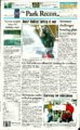
Show Sat/Sun/Mon/Tues, December 3-6, 2005 The Park Record B-2 AccuWeather.com* Saturday, December 3, 2005 ALMANAC REGIONAL FORECAST FIVE DAY FORECAST FOR PARK CITY Park City statistics for the week ending Dec. 1 SATURDAY A storm system moving across the region will linger, bringing some snow showers and flurries for Saturday. An area of high pressure will build into the region for Sunday, allowing for breaks in the clouds. A few flurries will still fly in the mountains on Sunday and Monday. Another storm will bring more snow for Tuesday, and very cold temperatures. SUNDAY MONDAY TUESDAY WEDNESDAY Intervals of clouds and sunshine A mixture of sun and clouds Mostly cloudy, snow or flurries possible Cold with times of sun and clouds Winds: N 3-6 mph Winds: NW 10-20 mph Winds: ESE 10-20 mph Winds: NNE 8-16 mph 29714° 33713 25714° Temperatures: High for the week Low for the week Normal high Normal low Average temperature Normal average temperature 46° 11° 39° 18° 25.7° 28.2° _ . . . ., Precipitation: T * . , .u I, Total for the week Total for month thru December 1 Total for the year Normal for the month Normal for the year % of normal this month % of normal this year Most | y cloudy, snow showers; colder 1.11" 0,28" 19.55" 0.09" 18.90" 328% 103% Winds: N W 7 - 1 4 mph ( n i 27712 32719 REGIONAL CITIES ACCU WEATHER UV • •••• High Saturday 2 High Sunday 2 M High Monday 2 J™ 0-2, Low; 3-5, Moderate; 6-7, High; 8-10, Very High; 11+, Extreme Values indicate the exposure to the sun's ultraviolet rays. Shown is the highest value for each day. > l " SUN AND MOON Saturday Sunday Monday Tuesday Sunrise 7:32 a.m 7:33 a.m 7:34 a.m 7:35 a.m Sunset 4:59 p.m. 4:59 p.m. 4:59 p.m. 4:59 p.m. Saturday Sunday Monday Tuesday Moonrlse 10:07 a.m 11:00 a.m 11:42 a.m 12:15 p.m Moonset 6:51 p.m. 8:06 p.m. 9:25 p.m. 10:42 p.m. MOON PHASES First New Last Full Shown Is Saturday's weather. Temperatures are j Saturday's highs and Saturday night's lows. Grand Canyon 46/10 Dec 8 Dec 15 NATIONAL CITIES Saturday Crty Albany Anchorage Atlanta Atlantic City Boston Buffalo Charlotte Chicago Cincinnati Cleveland Columbus, OH Dallas , . „ „ , Denver HI 37 14 52 43 41 32 Lo 25 5 48 28 30 24 W pc c sh pc pc sf 52 32 37 32 34 76 36 46 20 30 24 30 44 14 sh sf r pc pc pc sf ROAD CONDITIONS City Aspen Boulder Butte Colorado Springs :o Ely Evanston Flagstaff Gallup Grand Canyon Grand Junction Gunnison Idaho Falls Jackson Hole Mesquite Missoula Ogden Page Pocatello Provo Pueblo Reno Rexburg St. George Saft Lake City Spokane Sun Valley Tahoe Twin Falls Yellowstone Saturday HI Lo W 30 9 sn 36 13 sf 20 -2 sf 36 16 sn 32 13 c 33 5 c 24 6 sf 46 19 sh 51 22 sh 46 10 sh 39 19 sh 34 9 sn 24 11 sf 22 6 sf 60 35 pc 24 15 sf 33 22 sf 54 32 sh 26 15 sf 36 20 sf 40 16 sh 41 18 pc 23 8 sf 58 32 c 33 23 sf 26 18 sf 23 4 sf 36 8 pc 32 18 c 15 -6 sf Sunday Hi Lo W 20 -3 sn 25 11 sn 16 6 sf 28 10 sn 32 11 pc 32 8 s 18 6 sn 40 13 s 39 5 pc 36 6 s 32 12 pc 24 -6 sn 19 8 sn 20 4 sn 53 31 s 25 20 sf 28 16 pc 43 23 pc 22 10 sf 30 14 pc 32 10 sn 39 18 pc 20 10 sf 50 28 s 30 16 pc 26 20 sn 20 5 sf 38 11 pc 29 16 pc 9 3 sf Interstate 80: A few snow showers and flurries will cause the visibility to drop below 1 mile. Northwest winds at 7-14 mph. US-40: A couple of snow showers and squalls will make driving difficult at times. Northwest winds at 8-16 mph. TRAVELERS FORECAST There will be a few snow showers and flurries across the region on Saturday, especially as travelers head farther to the south. Conditions will begin to improve by Saturday night as high pressure begins to build into the region. WEATHER HISTORY On Dec. 3, 1886, a storm dropped more than a foot of snow from central Alabama to the western Carolinas. Rome, Ga., received 25 inches, and Asheville, N.C., had 33 inches. Forecasts and graphics provided by AccuWeather, Inc. ©2005 WORLD CITIES Sunday HI 36 18 67 45 38 34 60 30 39 32 36 54 28 Lo W 23 c 8 c 47 t 28 r 28 sn 25 sf 48 sh 16 pc 24 c 24 sf 24 c 34 pc 12 sn Saturday City Des Moines Detroit Dover Houston Honolulu Las Vegas Los Angeles Miami Minneapolis Nags Head New Orleans New York Norfolk HI 28 32 42 84 82 62 66 77 20 52 80 38 48 Lo 13 22 31 66 70 40 46 65 12 47 65 32 44 W sn c c pc pc pc s s sn pc sh pc c Sunday Hi Lo W 23 10 c 30 20 pc 40 30 sn 79 44 t 82 69 sh 55 34 s 70 48 s 79 67 s 18 6 c 67 50 Sh 81 53 t 39 32 sn 62 40 r City Oklahoma City Orlando Philadelphia Phoenix Pittsburgh Providence St. Louis San Antonio San Diego San Francisco Seattle Tampa Washington, DC Saturday Hi Lo W 55 32 pc 74 54 s 40 30 pc 72 48 pc 33 24 pc 40 26 pc 41 24 sn 82 60 pc 64 49 s 57 42 pc 40 34 pc 72 58 s 42 34 c Sunday Hi Lo W 43 28 pc 78 58 pc 37 30 sn 68 43 s 33 22 sf 39 27 sn 36 23 pc 76 42 pc 65 48 s 60 44 pc 42 38 sh 76 62 pc 46 30 r Saturday Sunday Saturday Sunday City Hi Lo W Hi Lo W City HI Lo W HI Auckland Bangkok Barbados Beijing Berlin Buenos Aires Dublin Frankfurt Hong Kong Jerusalem London Montreal 70 60 pc 91 77 t 85 76 pc 34 10 pc 37 27 sn 73 62 t 46 39 sh 41 37 c 79 56 pc 81 59 s 46 41 sh 29 17 sf 72 93 85 26 41 79 46 40 72 76 46 28 62 75 76 13 34 64 37 33 63 54 39 16 Moscow Oslo Paris Rio de Janeiro Rome San Juan Seoul Sydney Tokyo Toronto Warsaw Zurich 28 34 46 73 59 83 37 77 57 28 34 37 23 27 41 65 48 71 25 57 36 23 30 32 31 17 c 32 27 c 48 41 r 81 71 s pc t sh pc sh s c r pc s pc sf c sf sh pc r s sf pc sh sf c sn 59 85 30 84 57 32 36 45 NOTHING YOU NEED TO KNOW. EVERYTHING YOU CAN'T RESIST. 52 75 19 61 41 21 pc sh pc s sh sf 30 sh 37 r Weather (W): s-sunny, pc-partty cloudy, c-cioudy, sh-showers, t-thunderstorms, r-rain, sf-snow Hurries, sn-snow, l-ice. MOUNTAIN REGIONAL WATER SPECIAL SERVICE DISTRICT NOTICE OF RATE HEARING the green gifts issue, at all your favorite hangouts december I . Lo W Public notice is hereby given that Summit County Commission, acting as the Governing Board of the Mountain Regional Water Special Service District, Summit County, Utah, will meet in Regular Public Session to receive public comment on a proposed decrease in the District's standby fee from $38.50 to $33.50 per month. A reduction in the standby fee has been recommended by the Citizen Advisory Committee. The District also proposes to annually adjust the interest rate assessed on a release of covenant based upon the five year State Treasurer PTIF average plus 1%, as determined each January. For information about the entire rate base and overages please contact Mountain Regional Water Special Service District at 435-940-1916 ext 302. This meeting will be held on Wednesday, December 14, 2005 in the Commission Chambers of the Summit County Courthouse, 60 North Main, Coalville, Utah. The meeting will commence at 6:30 PM. |