| OCR Text |
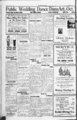
Show LEHI FREE PRESS, LEHI. UTAH Stony yMAPS J, r'v" ' Covered Bridge Era Passing Requirements of Modern Transportation Doom Picturesque Old Structures So Long Landmarks in Vermont; Many Date From Revolution. Well In the foreground of the! rugged scu!e beauty of Veruint are the covered bridges, which lead many roadways over turbulent streamt and link the Green mountain past with modern transportation. Thousands who have passed of motorists tbrougn the state will remember the which rumble from floor plunk echoed Into the roofed spans, as they passed from sunshine Into gloom then out again Into the sunlight These quaint structures often served as landmarks, some datlnjt hack to days of the Revolutionary war. Previous to 1927 there were 6 tween 500 and 600 bridges of the covered type In Vermont The flood of that rear, however, destroyed more than half of them. Today there are onky 240 remaining Approximately fifty have been replaced with modern structures during the last six yeara. The Vermont department of his;b ways, being aware not only of the picturesque appeal of these ancient structures, but of the sentiment attached to them, has shaped policy to retain as many as practical from an engineering standpoint However Increasing volumes of travel and mounting traffic speed have necessitated the removal of some of these spans, especially those on main-lin- e highways. Almost all of the covered bridges have exceptionally strong trusses, but the floor systems are usually too weak for heavy motor traffic. It has been reported In state-widsurveys. Often times new floor systems may be Installed without great expenditure. It has been found, but the chief locations of serious disintegration are at the ends of the structures, where wood supports have been In J Prepared by National Oeorraphle Boclaty. Barvtea. Washington. U. MU than 3,000 years ago II, who is credited MOKE making the first maps, outlined estates along the Nile river. What would he think today If he walked Into an automobile service station, railway station, tourists' bureau, or airplane office and could take his pick of maps that would show him the best route to almost anywhere in the world? Probably the greatest spurt In the industry has been made in the last few centuries, but in the great museums of the world there are many maps and charts that were crude but helpful forerunners of the efficient work of cartographers today. Most famous of all early maps are those in the atlas or "Geography" of e Claudius Ptolemy, an work from 150 D. A. about dating Though lost to the world of learning through the Dark ages, Ptolemy's books were later rediscovered. One of the oldest manuscript copies was found at Mount Athos, and a reproduction made in 18C7 is on display in the Library of Congress at Washington, D. G Six of his eight books consist of tables f latitude and longitude for about 8,000 places. In his remaining books Ptolemy discusses the stars, mathematical problems of geography, the length of days, the sun's course, and differences in Wme at different places. With his books are maps of 26 countries and one map of the world. In is colossal task Ptolemy used all geographic lore that had accumulated to his time. Though crude and full of mistakes, it was the greatest step ever made in presenting world geography In scientific! form. Els maps show how traders and adventurers had pushed the rim of the known world as far north as the Shet-land- s and given size and shape to the British Isles More of the Nile was shown and part of Africa below the equator. The Indian ocean got a new and more accurate mapping, based, no doubt, on notes brought by silk traders from the Far East Road Maps for Crusaders. To meet the needs of the Crusaders, flocking down the highways of Europe and Into Asia Minor, there developed a sort of pictorial road map. A good example in the British museum is a copy of a drawing by a St. Albans smonk, Matthew Paris. Its crude pictures show the towns along the route from London to Jerusalem. The "map" of Palestine also shows the sea, with ships carrying crowds of people. China, Persia, Egypt, all had their part in early map science; and the Arabs undoubtedly borrowed from Ptolemy. Yet it was the Arabs who, irhen Christian learning lagged in the Eighth and Ninth centuries, made the most important geographic advances. Printing, which, like the compass, probably came to Europe from the East, had the same galvanic effect on map making as on some other arts. Ptolemy's "Geography," now translated, became so popular that it was to go through more than fifty editions. Columbus used it; despite Its errors, or thanks to them, he accidentally found the New world, which discovery ultimately set all civilization to revising Its maps. For decades after the voyages of Columbus, Europe seethed with excitement and new ideas. When Charles V received letters from Cortez describing the splendors of Montezuma's court, with Its golden dishes as big as carriage wheels, all Spain was agitated. When news broke thafPizarro had caught an Inca king and held him for ransom of a roomful of gold, equal to $15,000,000,-excitemewas almost unendurable. All nations that could build or borrow boats put to sea, and map making flourished. As the world's true pattern took form, medieval maps with unexplored areas decorated by sea serpents, mermaids, wrecked galleons, and chubby angel faces blowing the winds, began to fade from use. , Great Work. Gerhard Kremer, known by his Latinized name of Mercator, was among the first to break with these old Famous methcmatlclan and map-makin- g eight-volum- nt r's a. cartographer of Flanders, he drew a world chart in 15C9 on the "Mercator Projection," which gave navigators a new and safer system for plotting their courses. By this projection lines of latitude and longitude are mathematically spaced and drawn at right angles to each other. On this grid sailors have merely to rule a straight line as their course and sail to port Because the earth Is round, this does not give the shortest route between two points, but it does show the right "bearing," In his time, Mercator helped to change map making from an art Into a science. New and accurate instruments for measuring the ground were coming into use, and slowly they led the way to topographic surveys. Mercator'a son, Bumold, carried on his father's map trade. When Rumold died his brother-in-laJudocus Hon-diu- s, took it over. The Hondius earth map of 1595, now In the British museum, traces Sir Francis Drake's course around the world. Dutch map publishers led the world In the Seventeenth century and the French In the Eighteenth. A French scientist rolled a carriage wheel across the northern French plains to measure a degree arc of the meridian. In time came D'Anvllle, Issuing a new map of China drawn by the Jesuits In 1718. Other good map makers arose in Ger many, England, Austria and Switzer land. No country is so well surveyed as Great Britain; no maps anywhere are comparable, for Information and range of scale, with those of its ordnance survey. Early American Maps. Before the Revolution such maps of our country as existed were drawn mostly by those European powers who had colonies here. Among such were the early Spanish maps of Florida, the Southwest and California; also Lewis Evans' map of the "Middle British Col onies In America," published In Philadelphia In 1755. What has been called the most Im portant map In United States history is that drawn by Dr. John Mitchell, showing the French and British dominions In North America. After Cornwallls yielded at Yorktown and British diplomats met the Americans at Paris to frame the treaties of 1782- 83, this map was nsed. Of It John Adams wrote: "We had before us . . . a variety of maps; but it was the Mitchell map upon which was marked out the whole boundary lines of the United States." During the first half of the Sixteenth century such Spanish explorers as Cabeza de Vaca, Coronado, De Soto, and others had made crude maps of their routes; so had the French, voy aging the Great Lakes and canoeing down the Mississippi William Clark, of the Lewis and Clark expedition, in 1804-6- , made a map showing their route to Oregon and the north boundary of Louisiana, then in the uppet Missouri basin. Later came Zebulon Pike, the Santa Fe traders and the beaver trappers from St Louis Bonneville, Walker, Fremont, and others-- all shown on Frank Bond's "Routes of the Principal Explorers," published by the United States land office in 1907. No ship can enter port safely without a chart that shows buoys, lights, shoals, channel depths, and prominent objects ashore to steer by. The United States coast and geodetic survef has been making such charts for 116 years. After the Civil war, mapping of the United States, particularly of the great West, began In earnest directed by the newly created United States geological survey. Long before that to aid settlers, the government land office had done much mapping, often under contract and not always accurate. Because the United States Is so vast no private firm or person could affoid to survey and map Its whole area. For more than (SO years the geological survey has been working to complete the topographic mapping of the Union. Of Its trial area of more than 3,000,000 Is now square miles, about one-hal- f surveyed and the results published In nearly 8,800 typographic maps. Inspiration to All in Really Spiritual Life ever-mouctin- j Sixteenth Century Map of the Pacific. throughout the oatioa to tour the Green scountatn territory. With these facta li mind, road bu'.IJtrs have asserted that In order to meet traffic conditions, main line covered bridges will hare to be replaced In the futile. Tet there wilt b great many on secondary and town roads which will continue to support traffic and w hich will be pre served as long as possible. However as no covered wooden bridges are now being built, there will come a day when these types of structure wjll become extinct as far as Vermont Is concerned. e contact with earth. In a number of cases. It has been discovered, that disintegration has progressed to such an extent that the bridges must be rebuilt These structures are. or course, very old and as time goes on more a no more of them will become unsound. The principal reason stressed for the replacing with modern. pen structures Is the guarding of traffic safety. The old bridges were built during times when traffic was light and slow In almost every Instance they were constructed at right angles to the streams which the? crossed, with the result that dangerous, sharpangle turns existed at each end of the structures. Thla. togeth er with the fact they were narrow and often made many unfit to meet the requirements of modern travel. Pride In these covered bridges has become deep rooted In the state, how ever, am when safety requirement are fulfilled the spans are not replaced unless the expense connected with necessary repairs or maintenance becomes prohibitive or loca tion or design cause traffic hazards which cannot be remedied. An Important move toward the preservation of ihe bridges was made by the Vermont legislative assembly this year, when a law was enacted which specified that the state might s the cost of maintepsy nance on state aid roads. Although there Is distinctive attractiveness to the covered bridges, traffic experts now declare that their days are numbered. According to unofficial figures motor travel In Vermont this year has established a new peak, and an Increasing Interest has been evinced by motor vacationists Skyscraper Found to Have Its Disadvantages The aimless way sky not only In New York, but in other cities, is causing much congestion For that reason. In the opinion of Flavel Sburtleff. secretary of the na tlonal conference on city planning, the skyscraper Is having the fight of Its life to Justify the enormous cost with which It has burdened the taxpayers for traffic facilities. "Skyscrapers have been generally on this aide of the Atlantic as both necessary and desirable." writes Mr. Shurtleff in Progress Magazine "Theoretically, the height of buildings Is Immaterial except that height Is deprecated when It creates excessive bulk In relation to the traf flc capacity of the area. "Even In Texas, where land Is so abundant and cheap that ten acres are allotted to one steer for pastur age, at least four cities boast borne made sky lines, which are assumed to be the hallmark of metropolitan distinction Houston's skyline In eludes five buildings of more than twenty stories In height housing thousands of tenants on less ground than would suffice to nourish one steer elsewhere In the state." low-arche- aci-epte- two-third- AmW In which scraers have been crowded together, Aye, That's the Rub "How much would you give for hair like mine?" "now much did yon give?" Something was said la my meditation a few weeks ago of the art of living, of which so man people k.ow so little, a writer In the Indiao-apoll- a News comments. It Is one of the greatest of the arts, and also one of the most difficult Strong, clean, pure, beautiful and self denying living Is a supreme work of art and. as such, an inspiration to all who come, and especially those who- - live within the sphere of Its Influence. Delight aa we may. and should, in a superb literary style. It Is after all the superb life and II may be superb, do matter how humble that exerts the greater Influence. Is this also "the gift of God"? Very obviously noL Such a life Is the expression of character, and character is the fruit of self culture, self renunciation aiJ Its cost of production, measured In pain, sacrifice, suffering and bard work. Is enormous and yet so great la the result character as to be worth all It costs. Perhaps there are few of us who hare not known people who Uvl nobly, seriously and yet Joyously, unaware of their own goodness. We Lave also known people who were selfish, flighty, without dignity, devoid of any sense of responsibility for the outcome of their own life or the lives of others. The first class Is made up of serious artists In the difficult art of living. In the seconO class are the botchers and there are many of them. The most hopeless folk are those who would and do divorce beauty and morality and bold that they are natural enemies, Sucb misguided and misguiding souls know little or nothing of "the beauty of holiness " - "A' Poplar Laited Long Water does not always cause decay of wood, as Is shown by the fact that a bell tower In Venice was built on poplar piles In 900 A. D., and these piles needed only to be used when the tower was rebuilt a few years ago. Kansas City Times. 0v jj5 j'jjy (3 0 uu GREATER PROTECTION GIVE 58 0, ,5 .' six million people have seen the Extra patented Firestone construction features d and Two Extra of Cord Plies Under the Tread at "A Century of Progress." These millions know novo more than ever before why Firestone Tires hold all world records, on road and track, for Safety, Speed, 'J Gum-Dippi- , i se S .a. OnY-- f tiaaltMAefieaM Si Flmton msJt ' HT, Tift Cum-Dlpp- tJ W tka scfaatfAc rib bar cv Ubll fa tit HMcl Sdtac aratMitta 2 hr ftrastoa tkt World; M "A Caatarya Mileage, andJEndurance. If you have not seen how Firestone Tires are made if you do not know what is under the tread of a tire Let your nearest Firestone dealer show you the Extra Strength Extra Safety Longer Mileage and Greater --Blowout Protection built into Firestone Gum Dipped Tires. You are going to need new tires this fall and winter Don't put off buying another day! You will pay more later. 1 rade the n danger in your present VII f;' & M . Gum-Dippe- ng ': - TV ! 5 tires for the Safety in Firestone H ( tia rtqaart a Gum-Dipp- Tires F,h Coamm.a Tires in the World, Pnta." Ofna MaerimiBIMaaai ' -- Jt OF TIRE CONSTRUCTION LSI fJT Liivv SUPER OLDflELD TYPE Ford..) iCberr. I EVERY PLY IS $7.10 Focdl BLOWOUT PROTECTED BY GUM-DIPPIN- tni MASTERPIECE THE NEW EYERYFIBERIN EVERY CORD IN "TiMss: ed the Safes t ".,,h;rf 4.7H9I N h- 5.5-te- 1.00-- 0 S5Q.1t Otkw G lBulck.1 Chew. J Stnd'r) torn rreporttxalrfr Ln t il SUrEK OLDflELD IYPE 0,. 1 If Built to equal all first line standard brand tires la quality, construction and appearance, but anlower in price other Firestone achievement ing money owners. in sav- for ear LOW PRESSURE f . a'"' TRACTOR TIRES "32& awBSi-.ary:22?!- . fle The tire to increase the efficiency and Firestone economy of your tractor Pneumatic Tractor Tires in tests plowed 27 more acres, with 23 saving in fuel and a 23 increase ia to 36 speed. (Tests made by Ohio State University.) Urea Equip with these now. lubjcct to change without notice) SERVICE DEALER OR SERVICE STORE -B- UY TODAY BEFORE 1. it AH prices CO TO YOUR LOCAL FIRESTONE PRICES GO HIGHER |