| OCR Text |
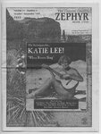
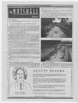
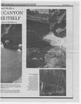
Show THE CANYON By Liz Thomas 6 Herb COUNTRY McHarg of the CEDAR CITY HIGHLIGHTS Cedar City is abuzz with new construction projects this summer. Of course, there's the Southern Utah WATCHDOG Wilderness Alliance requests for exploitation of the monument's natural resources. 10. The practice of “chaining” (dragging a huge ship anchor chain between two bulldozers and ripping out all the pinyon, juniper, sagebrush and other vegetation along the way) to “improve” the desert range and vegetation will not be allowed in the primitive areas. 11. With respect to Animal Damage Control, that insidious taxpayer funded agency that kills wildlife in order to “protect” non-native domestic livestock, the plan bans the use of all poisons, traps, and M44s, and allows “coyote control measures” in only very limited giant Walmart extravaganza, which we're all anxiously awaiting and which has progressed so far as to completely denude 15 acres of sage and juniper. Then there's the creek circumstances. “improvements” which include lots of bright lights, retaining walls, and an inane raised asphalt trail complete with a bright yellow dividing line that heads up the canyon and replaces the entirely adequate gravel path. And not to be outdone by the hedonistic Moab, Cedar City is getting a new business SUWA filed a protest asserting, among other things, that the ORV route designations and the abysmal Wild and Scenic River recommendations do not meet regulatory requirements, that BLM's new wilderness re-inventory information should have been included in the plan, and that the impacts of the 888 miles of pubic road were not properly analyzed. called Pub and Bakery. That's what the sign says, but don't be fooled. It will NOT be serving beer. Huh? So...folks wanting a cold one will be turned away and those who (publicly) condemn beer-swilling taverns from hell will stay away because of the misleading sign. I'm thinking that a new name is in order...fast...if this alcohol-free "pub" wants to survive in Cedar. Speaking of signs, signs are proliferating at the speed of light in CC. In particular, one of the businesses that shares the building with the SUWA office appears to be supporting the sign industry single handedly. Things got off on the wrong foot from the get go. The business (call it D.U.H.) defaced the only two yin-yang symbols in western Utah by putting its first two signs right on top of them. These particular yin-yangs were built into the face of the building when it was constructed many decades ago and were the most interesting features on Main Street. Next came the giant, reflective gold letters spanning the front of the building “There's No Place Like D.U.H. Home Loan Corporation.” Not to mention D.U.H.'s FIVE hard-plastic placards stuck on the inside door leading to SUWA's office, plus the 14 placards leading more immediately into D.U.H.'s inner sanctum. Ok, one office, three signs on the outside of the building announcing its whereabouts, plus about 25 signs inside the building seem like plenty. Well...the latest addition has large green reflective letters placed below the glaring gold ones. Calls to the building owner were dead-ends (“gotta let the public know how to find D.U.H.” ). Calls to city hall revealed that Cedar has no sign ordinance. Big surprise. SUWA FILES PROTEST ON GSENM MANAGEMENT PLAN The BLM has issued the Final Environmental Impact Statement (EIS) and Management Plan for the Grand Staircase-Escalante National Monument (GSENM). The Presidential Proclamation that established the Monument in 1996 (which, you may recall, was immediately termed as a “land grab” by Kane and Garfield county commissioners) directed the BLM to manage the monument to protect the geologic, archeological, paleontological, historical, and biological resources and objects contained therein. The nearly 1.9 million-acre monument was not designated in order to become a desert Disneyland and ORV playground. Nor was it created to become a huge oil, gas and mineral development zone—much to the chagrin of some Garfield County Commissioners. Although the nearly 400-page final plan is a step in the right direction for managing this area in its natural state, it falls short in several instances. The following is a quick and dirty summary of the Final Plan. 1. Many miles of unnecessary jeep trails trials that served no purpose — were closed. However, the plan leaves 888 miles of routes open to motorized vehicles, This is an excessive amount, given the area's value for being remote. 2. All cross-country ORV travel is prohibited. Unfortunately, the plan allows ORVs on 543 miles of designated routes within the monument. Given the BLM's abysmal track record for patrolling ORV use areas and its lackluster performance in keeping ORVs on designated routes and out of closed areas (for example Canaan Mountain, Moquith Mountain, and Parunuweap Wilderness Study Areas), there is good reason to doubt that these route designations will be fervently enforced. 3. Most of the current 880,857 acres of Wilderness Study Areas (WSAs) in the monument will be managed as “primitive,” which is nearly wilderness management. Inexplicably, however, BLM failed to incorporate its recent wilderness re-inventory findings into the final plan. Some of the areas that should have been zoned as primitive include Studhorse Peaks, Upper Kanab Creek, Warm Creek, Nipple Bench, and Four Mile Bench. These lands are included in America's Redrock Wilderness Act (H.R. 1732/S. 861) and are also being considered for wilderness designation under the current FLPMA 202 process and should be managed to protect their wilderness values until Congress makes the final call. 4. The limits on group size for most areas are unduly large, especially the group size limit for primitive areas which allows 12 people and 12 animals per group. 5. Outfitters and guides will be allowed on 100% of the monument if their proposed activities are appropriate with the management zone 6. Competitive events will be prohibited monument-wide. 7. Dispersed camping is allowed on 94% of the monument. 8. The plan proposes to address grazing and its impacts by applying existing laws and regulations within the next three years. These same laws and regulations already apply to grazing on all BLM lands, although the agency has been negligent in coinpleting the required reviews and in taking the appropriate action upon completion of such reviews. Sooner would be better. 9. The plan is weak with respect to mineral leases (hardrock, oil, gas); it merely states that there are leases in the monument that were in place at the time the monument was designated, and that the lessees have either valid existing “rights” or at least “interests.” Subliminal Message from Liz..."Help me...I live inCedar City!.. HELP me!" BLM PROPOSED TO KEEP CORAL PINK SAND DUNES OPEN TO ORVs In its newly released Environmental Assessment (EA) WSA. It even goes so far as to call ORV use an “historic, traditional use.” SUWA was not aware that ORVs were historic. The dunes in the WSA are home to many plants and wildlife species, including Welsh's milkweed which is listed as threatened under the Endangered Species Act, and the Coral Pink Sand Dunes Tiger Beetle which is a candidate species for listing (SUWA has petitioned for its listing as an endangered species along with critical habitat). Although the entire 3,500 acres of dunes is designated as critical habitat for the Welsh's milkweed, BLM's proposal would allow ORVs to ride unchecked in this critical habitat, in addition to areas that are recognized as primary habitat for the tiger beetle. BLM's interpretation of Darwin's theory would pit ORVs against all things living just to see what could happen. BLM acknowledges that the quality of non-motorized visitor experiences would be reduced due to the “distracting” (a.k.a. ear-splitting) noise of ORVs, and that opportunities for visitors to find solitude and primitive recreation would be “sporadic.” BLM even reports that 95% of the visitors to the area are not riding ORVs. However, the agency still proposes to allow such an obviously conflicting use to satisfy a minuscule fraction of users who already have access to the vast majority of the dunes within the State Park. CONOCO APPLIES FOR PERMIT TO DRILL IN MONUMENT The BLM recently issued the Environmental Assessment (EA) for Conoco's Application for Permit to Drill (APD) for its proposed exploratory oil well on the Kaiparowits Plateau, inside the Grand Staircase-Escalante National Monument. The well, proposed to be drilled to a depth of 14,000 feet, is located in the Smoky Mountain area within the Warm Creek proposed wilderness—an area included in both America’s Redrock Wilderness Act and the BLM’s recent wilderness inventory. ° All indications are that the BLM is ready to approve the well, even though the Presidential Proclamation creating the monument declared that it was being established for the protection of its biological, historical, and cultural resources and its natural wonders. A decision by BLM to allow drilling sends an explicit message that the agency places a much higher value on natural resource exploitation than on protecting the fragile ecosystem . and naturalness of the monument. Clearly, oil wells, tanker trucks, gas flaring, huge roaring generators running around the clock, and glaring night lights for 24-hour operations are not consistent with the purposes of the monument. SUWA has requested that BLM's EA be withdrawn and a full-blown, area-wide Environmental Impact Statement be prepared in order to assess the potential cumulative and direct impacts that development of Conoco's wells (six pending APD's at last count) would have on the monument and wilderness values in the Smoky Mountain area. The plan is silent as to conditions (such as no road upgrades, no noise level increases, no hazardous waste dumping, no open waste pits, no night lighting) BLM would impose on lessees in order to protect the monument's resources. Given that there are 178 oil and gas leases covering 213,000 acres, and 25 coal leases covering 57,000 acres, the plan should have stated explicitly the environmental conditions BLM would require in order to approve BLM proposes to continue to allow off-road vehicle (ORV) use within the Moquith Mountain Wilderness Study Area (WSA). The BLM's preferred alternative is to keep11.5 miles of ORV routes open and to allow ORVs unlimited access to 710 acres of beautiful coral sand dunes within the WSA. The BLM's EA is nothing more than a weak attempt to rationalize ORV use within the Continued on next page... |