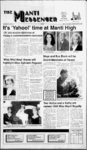
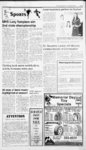
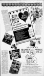
| OCR Text |
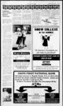
Show nr s4 nfi 'f"1 )' t - Dated this 16th day of May, 1995. UNITED NOTICE OF TRUSTEES SALE The following described real property will be sold at public auction to the highest bidder, purchase price payable in lawful money of the United States of America at the time of sale, in the front foyer of the Sanpete County Courthouse, at or about 160 North Main, Manti, Sanpete County, Utah, on Tuesday, June 20, 1995, at the hour of 1 1 :00 a.m. of that day for the purpose of foreclosing a trust deed executed by D. Vern Chadwick trustees real property will be made with- out warranty as to title, possession, or encumbrances. DATED this 19th day of May, 1995. sA. BRAD SLACK A. BRAD SLACK STATE OF UTAH Mutual, A Federal Savings Bank fka Prudential Federal Savings and Loan Association as beneficiary. The aforesaid deed of trust was recorded on October 2, 1978 in book 199, page 413, entry no. 241960 in the official records of Sanpete County, State of Utah. The real property covered by the aforementioned deed of trust and this notice of trustees sale is located at 495 South Main Street, Manti, Sanpete County, State of Utah, and is more particularly described as follows: Beginning at the Southwest comer of Lot 2, B lock 7, Plat A, Manti City Survey, thence North COUNTY OF SALT LAKE On this 19th day of May, 1995, personally appeared before me A. Brad Slack, who being by me duly sworn, did say that he is the Assistant Vice President of Washington Mutual which is chartered under the laws of the United States of America and authorized to do business in the state of Utah, and that the foregoing instrument was signed on behalfof Washington Mutual by authority of its bylaws or a resolution of its Board of Directors, and said A. Brad Slack acknowledges to me that 101 feet; thence East 102 feet; thence South 101 feet; thence West 102 feet to point of beginning. The beneficiary directed the trustee to foreclose the aforementioned deed of trust for the purpose of paying certain obligations secured thereby, including the un OF AMERICA s John A. Morgan District Director Rural Economic and Community certhat balance of paid principal Development tain note, dated September 27, State of Utah 1978, all accrued interest to date, United States Department of Agany late charges authorized by the riculture. note, and all costs, expenses, and Exhibit "A" fees associated with the preparation of this notice and the foreclo- Parcel 1: Beginning Southeast corsure sale of the trust property. The ner Section 28, Township 19 1 East, Salt Lake sale of the aforedescribed South, Range and Carole C. Chadwick, as Trustors, in favor of Washington 1 STATES SS. said association executed the same. sLorraine H. Huber Notary Public Residing at: Salt Lake City, Utah My Commission Expires: April 24, 1999 Publish Manti Messenger May 25, June 1,8, 1995 Meridian; thence North 10.90 chains, south 88 deg. 30' West 11.20 chains. South 6.35 chains, North 89 deg. West 20.20 chains, chains of beginning. South 88 deg. East 3.45 chains to beginning. LesS Railroad. Containing 19.59 acres. EXCEPTING THEREFROM that part in the Railroad right of way. Parcel 10: Beginning Southwest Comer, Southwest Quarter, Section 27, Township 9 South, Range East, Salt Lake Meridian; thence North 10.90 chains. North 88 deg. 30' East 20.20 chains, South .43 chains to Railway, Southwest along Right of Way to Section Line, West to point of beginning. Containing 18.09 acres. Parcel 11: Beginning Southeast 1 1 Corner, Southwest Quarter of Northeast Quarter, Section 27, Township 9 South, Range 1 East, Salt Lake Meridian; thence West 7.81 chains, to R.G.W. Railway, 1 South 4.85 chains, East 31.20 chains to beginning, containing 21.30 acres. Parcel 2: Beginning 11.26 chains West, 4.30 chains North, from Southeast Comer, Southeast Quarter, Section 28, Township 19 South, Range 1 East, Salt Lake Meridian; thence North 89 deg. West 20.20 chains. North 5.45 chains, North 88 deg. 30' East 20.20 chains, South 6.35 chains to beginning, containing .95 acres. North 45 deg. 33' East 10.90 chains. South 7.71 chains to point of beginning. Containing 3.01 acres. Parcel 12; Beginning 8.75 chains West, South II deg. West 19.80 chains Northeast Comer, Northwest Quarter, Southeast Quarter, Section 27, Township 19 South, Range East, Salt Lake Meridian; thence South 74 deg. 30' West 300 Parcel 3: Southeast Quarter of feet, South 15 deg. 30' East 150 Southeast Quarter, Section 27, feet. North 74 deg. 30' East 50 feet. Township 19 South, Range East, South 15 deg. 30' East 170 feet. Salt Lake Meridian. Containing 40 North 74 deg. 30' East 250 feet. acres. North 15 deg. 30' West 320 feet to Parcel 4 Beginning Northeast Corbeginning. Containing 2 acres. ner of the Northwest Quarter, Together with 783 shares of Southeast Quarter, Section 27, Water Stock in the Gunnison IrriTownship 19 South, Range East, Company. Salt Lake Meridian; West 8.75 gation with all the improveTogether chains, South 11 deg. West 19.80 ments and appurtenances thereunto chains, East 12.38 chains, North belonging or in anywise appertain18.65 chains to beginning. Coning thereto, including, but not limtaining 20.3 acres. EXCEPTING ited to, any and all irrigation and THEREFROM that part in the sprinkler irrigation equipment and Railroad right of w ay. lines; the water and water rights, Parcel 5: Northeast Quarter of ditch and ditch rights belonging to Southeast Quarter, Section 27, the above and foregoing described Township 19 South, Range East, tracts of land, including but not Salt Lake Meridian; ALSO begin- limited to 783 shares of water in ning 5 chains West and 989 feet the Gunnison Irrigation Company, South from the Northeast Comer and any and all grazing privileges, of the Northeast Quarter, Section permits, licenses, or leases. 27, Township 19 South, Range EXCEPTING THEREFROM East, Salt Lake Meridian; thence DETHE FOLLOWING 331 feet South, East 5.00 chains. SCRIBED PARCELS OF LAND South 20.00 chains. West 20.00 Beginning at a point 250.00 chains, North 659.40 feet to the feet West of the southeast Comer North side of Railroad. Northeastof Section 27, Township 19 South, erly along North line of Railroad I 1392.50 feet to beginning. Less Range East of the Salt Lake Base and Meridian; thence West 350.00 3.14 acres to Railway. Containing feet, thence North 250.00 feet, 73.37 acres, more or less. thence East 350.00 feet, thence Parcel 6: Southwest Quarter, SecSouth 250.00 feet to the point of tion 26, Township 19 South, Range 2.01 acres, East, Salt Lake Meridian. Con- beginning, containing more or less. taining 160 acres. EXCEPTING RIGHT OF WAY, as follows: THEREFROM that part in the Beginning at a point 600.00 lf of all Highland Canal, and feet West of the Southeast Comer minerals in or under said land inSection cf 27, Township 19 South, cluding. but not limited to metals, East of the Salt Lake Base oil, gas, coal, stone and mineral Range and Meridian; thence West 720.00 rights, mining rights, and ease- feet to Quarter Section line, thence ments. rights or other matters reNorth 620.00 feet more or less to lating thereto, whether expressed a fence comer, thence South 71 or implied. 35' West along said fence Parcel 7: Beginning 20.20 chains deg. 1 145.00 feet, thence North 72 deg. West. Northeast Comer, Section 30' West 70.00 feet, thence North 33. Township 19 South, Range I 17 deg. 30' East 25.00 feet, thence East. Salt Lake Meridian; thence 72 deg. 30' East parallel to South South 11.10 chains. North 89 deg. and 25.00 feet Northerly of the said .40 chains, North West deg. fence line 60.00 feet, more or less, East 10.90 chains. East 11.20 North 71 deg. 35 East chains to point of beginning. ALSO thence 1 1 75.00 feet, thence South 625 .00 1 1 1 1 1 1 1 NOTICE OF TRUSTEE'S SALE The following described property will be sold at public auction to the highest bidder, payable in lawful cash money of the United States at the time of sale, at the West front door of the Sanpete County Courthouse at 160 North Main Street in Manti, Sanpete County, Utah, on June 27, 1995, at 10:00 a.m. of said day for the purpose of foreclosing a trust deed executed by AS INDIVIDUALS Val Jean Hansen & Miriam D. Hansen (aka Meriam Hansen), his wife, Mariel O. Hansen & Etta Mae Hansen, his wife, Stephen L. Hansen & Janet L. Hansen, his wife, and LaRell C. Hansen & Debra Lee P. Hansen, his wife, and Hansen Dairy, Inc., a Utah corporation, as TRUSTORS, in favor of the United States of America, formerly acting through the Farmers Home Administration, United States Department of Agriculture, as TRUSTEE, for the benefit and security of the United States of America, as BENEFICIARY, dated June 25, 1986 and recorded June 27, 986, in Book 27 , Pages 1 1 Official Records of Sanpete County, covering real property located in Sanpete 606-61- 1, County, Utah and more particularly described as: See Exhibit "A" attached hereto and made a part hereof. real esThe offered for sale under be will tate two methods. In the first method. Parcel Nos. 1, 2, 7, 8 and 10 will be offered for sale as a single tract ("Tract 1") with 212 shares of above-identifi- ed Gunnison Irrigation Company Water Stock and appertaining sprinkler system; Parcel Nos. 3, 4, 5, 6, 9 and 11 will be offered for sale as a single tract ("Tract 2") with 400 shares of Gunnison Irrigation Company Water Stock and appertaining sprinkler system; Parcel No. 12 will be offered for sale as a single tract ("Tract 3"). In the second method, Tract 1, Tract 2 and Tract 3 will be offered for sale as a single combined unit. The final sale will be closed using the method that yields the highest overall bid price for the offered property. The minimun bid for the real property, water rights, and appertaining above-describ- ed w ill be as follows: sprinkler system ' Tract 1: $124,336.30 2: Tract $170,862.02 Tract 3: $24,172.00 Tract 1, Tract 2 and Tract 3 combined: $3 19,370.32 7 shares of Gunnison Irrigation Company Water Stock will be sold separately, and the minimun bid therefor will be $450.00 per share. Parcel No. 12 w ill be sold subject to a Mortgage executed by Stephen L. Hansen and Janet L. Hansen in favor of the United States of America, dated April 26, 974 and recorded on same date in Official book 173, Pages Records of Sanpete County, as as1 1 1 379-38- 2, signed. Irrigation Company Water Stock sold with Tract 2 will be sold subject to a special assessment and indebtedness to the Gunnison Irrigation Company. The sale will be made w ithout covenant or warranty regarding title, possession, or encumbrance, to satisfy the obligations secured by, and pursuant to the power of sale contained in the trust deed. In addition to, but not in limitation of the previous statement, it is specifically noted that no representation, covenant or warranty of any kind or nature is made with respect to the title to the following described real property: above-referenc- ed Beginning North 759.00 feet and East 792.00 feet and North 4 deg. 30' East 350.00 feet from the Southwest Comer of the Southeast Quarter of the Southwest Quarter of Section 27, Township 19 South, Range East of the Salt Lake Base and Meridian; thence South 74 deg. 30' West 120.00 feet, thence North 14 deg. 30' East 690.00 feet, thence North 46 deg. 00' East 285.00 feet, thence South 14 deg. 00' West 235.00 feet, thence South 1 1 1 1 1 1 1 beginning Northeast Corner, East 695.00 feet, Northeast Quarter. Section 33, feet, thence thence South 25.00 feet to the point Township 9 South, Range East, of beginning. Containing 1.12 Salt Lake Meridian; thence West more or less. 20 chains, South 10.75 chains, acres, East 20 chains, North 0.75 chains Publish Manti Messenger May to point of beginning. Containing 25, June 1,8, 1995 1 1 1 33.93 acres. EXCEPTING THEREFROM that part in the Railroad right of w ay. Parcel 8: Beginning Northwest Comer. Section 34, Township 19 South. Range East. Salt Lake thence South 10.45 Meridian; chains. Northeast on a curve along D.R G.W. Railroad 13.85 chains. West 9 chains to point of begin46 deg. 00' West 90.00 feet, thencij ning. Containing 4.70 acres. South 14 deg. 30' West 560.00 feef Parcel 9: Beginning 28.75 chains to the point of beginning. ContainWest, South 11 deg. West 1.50 ing 2.0288 acres. chains Northeast Comer, Southeast There may or may not be outQuarter, Section 27, Township 19 standing taxes or water assessSouth, Range 1 East, Salt Lake ments which would not be extinMeridian; thence South 11 deg. guished in this foreclosure sale. West 18.30 chains, South 74 deg. Notice of Default and Election 30' West 16.50 chains, North 14 to Sell said real property was redeg. 30' East 10.53 chains, North corded in said Official Records on 46 deg. East along West side of D. August 9, 1994, in Book 355. &R.G. W. Railroad Right of Way Pages to point North 88 deg. West 3.45 248-25- 2. SALE The following described property will be sold at public auction to the highest bidder, payable in lawful cash money of the United States at the time of sale, at the West front door of the Sanpete County Courthouse at 160 North Main Street in Manti, Sanpete County, Utah, on June 27, 1995, at 10:00 a.m. of said day for the purpose of foreclosing a trust deed executed by AS INDIVIDUALS Val Jean Hansen & Miriam D. Hansen (aka Meriam Hansen), his wife, Mariel O. Hansen & Etta Mae Hansen, his wife, Stephen L. Hansen & Janet L. Hansen, his wife, and LaRell C. Hansen & Debra Lee P. Hansen, his wife, and Hansen Dairy, Inc., a Utah corporation, as TRUSTORS, in favor of the United States of America, formerly acting through the Farmers Home Administration, United States Department of Agriculture, as TRUSTEE, for the benefit and security of the United States of America, as BENEFICIARY, dated June 22, 1987 and recorded June 23, 1987, in book 280, Pages beginning. West half 6, County, Utah, and more particularly described as: East half of the Northeast quarter and the East three quarters of the Northwest quarter of the Northeast quarter of Section 34, Township 19 South, Range 1 East of the Salt Lake Base Meridian. of the Northwest quarter of Section 35, Township 19 South, Range 1 East, of the Salt Lake Base and Meridian. Together with all improvements and appurtenances thereunto belonging or in anywise appertaining thereto, including, but not limited to, any and all irrigation and sprinkler irrigation equipment and lines; any and all water and water rights, ditch and ditch rights; and any and all grazing privileges, permits, licenses, or leases. The sale will be made without covenant or warranty regarding title, possession, or encumbrance, to satisfy the obligations secured by, and pursuant to the power of sale contained in the above-referenc- trust ed deed. There may or may not be outstanding taxes or water assessments which would not be extinguished in this foreclosure sale. The minimum bid for the real property with appurtenances will be $9,355.56 Notice of Default and Election to Sell said real property was recorded in said Official Records on August 9, 1994, in book 355, above-describ- ed all Official Records of Sanpete County, covering real property located in Sanpete Pages 248-25- 2. of May, Dated this 16th day UNITED 1995. OF STATES AMERICA s John A. Morgan District Director Rural Economic and Community Development State of Utah United States Department of Agriculture. Beginning at the Northeast Comer of the Northwest quarter of the Southeast quarter of Section 34, Township 19 South, Range 1 Publish Manti Messenger May East, of the Salt Lake Base and 25, June 1,8, 1995 Meridian; thence South 20 chains, West 20 chains, North 45 degrees East 28.28 chains to the point of Record, Douglas L. Neeley, at the following address: 96 South Main, 1 5, Ephraim, Utah, 84627; or (3) file their written claims with the Clerk of the District Court in IN THE SIXTH JUDICIAL 1 one-ha- The Gunnison NOTICE OF TRUSTEES 642-64- Page 10 Thursday, May 25, 1995 e, Messenger-Enterpris- " DISTRICT COURT OF SANPETE COUNTY STATE OF UTAH ANNOUNCEMENT OF APPOINTMENT 5-- Sanpete County, or otherwise AND NOTICE TO CREDITORS Estate of Carol A. Mortensen Deceased Probate No. 953600129 present their claims as required by Utah law within three months after the date of the first publication of this notice or be forever barred. DATED th is 5 day of Dec. 994 Leland Mortensen Personal Representative 1 Lcland Mortensen, whose address is 250 East 400 South, Ephraim, Utah, 84627, has been appointed Personal Representative d of the estate. Creditors of the estate are hereby notified to: (1) deliver or mail their above-entitle- j S Douglas L. Neeley Attorney for Personal Representative 96 South Main Ephraim, Utah 84627 5, written claims to the Personal Representative at the address Phone:(801)283-505- 5 above: (2) deliver or mail their Date of first publication May 1, written claims to the Personal 1995 Representatives attorney of Publish Manti Messenger May 11,18,25,1995 1 Snow College Activity Center Swimming Lessons Summer of 1995 ext. 384: Phil or Carol Green ext. 381: Susan First Session: June 7, 8, 9: Aquatics for cub scouts, blazers Boy Scouts. Second Session: June 12 - June 23: (Regular swimming lessons). Third Session: June 26 - July 7: (Regular swimming lessons) No class on July 3, 4. Cost: $1 3.00 (Preschool - Level VII) (801 ) 283-402- 1 , $1 1 .00 (Infant, Toddler) Fourth Session: July 10 July 21 : (Regular swimming lessons) Fifth Session: July 25 - Aug. 4: (Regular swimming lessons) Costs: $15.00 (preschool through Level VII - $13.00 (infant, toddler) INVITATION TO BID 1 It's The Most The Six County Area Agency on Aging is now accepting bids from providers for homemakerpersonal care services for adults 1 8 years of age and older. Preference will be given to those who can service the Six County area. Specific bid information can be obtained by writing or calling the Six County Area Agency on Aging, P.O. Box 820, Richfield 84701, The message, it seems, is in the medium. More ad dollars are spent on newspapers than in television, radio, direct mail, magazines, yellow pages, billboards or anything else. 896-922- 2. All bids are confidential and must be received by June 2nd, 1995. Contract period is for July 1, 1995 to June 30, 1996. Publish May 18, 25,1995 |