| OCR Text |
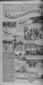
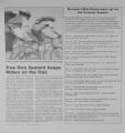
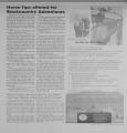
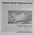
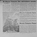
Show The Waterpocket Fold defines Capitol Reef National Park. A nearly near-ly 100 mile warps in the Earth's crust, the Waterpocket Fold is a classic, monocline: a regional fold with one very steep side in an area of otherwise nearly horizontal layers. lay-ers. A monocline is a "step-up' in the rock layers. The rock layers on the west - side of the Waterpocket. Fold have been lifted more than 7000 feet higher than the layperson the east. Maior folds are almost always associated with underlying faults. The Waterpocket Fold formed hpt.WPPTl SO anrl 7f years ago when a major mountain building event in western North America, the Laramide orogeny, reactivated reactivat-ed an ancient buried fault. When the fault moved, the overlying rock layers" were draped above the fault and formed a monocline. More recent uplift of the entire Colorado Plateau and the resulting erosion has exposed this fold at the surface sur-face only within the last 15 to 20 million years. The name Waterpocket fold reflects this ongoing erosion of the rock layers. "Waterpockets" are basins that form in many of the sandstone layers as they are eroded by water. These basins are common throughout through-out the fold, thus giving it the name "Waterpocket Fold". Erosion of the tilted rock lay- ers continues today forming colorful cliffs, massive domes, soaring spires, stark monoliths, mono-liths, twisting cyons and graceful arches. western part of the park, and the younger rocks are found near the east boundary. This layer upon layer sequence o sedimentary rock records nearly 200 million years of geologic history. Rock layers , in Sapitol Reef reveal ancient climates as varied as rivers and swamps (chinle Formation), Sahara-like deserts (Navajo Sandstone), and shallow ocean (Mancos Shale). HORSEBACK RIDING Horse and pack stock use is considered con-sidered a valid means of viewing experiencing Capitol Reef National Park. Animals designated as "pack animals" are limited to horses, burros bur-ros and mules. Stock use in any part may be prohibited when, at the discretion of the superintendent. LODGING Lodging in Capitol Reef National Park consists of the three campgrounds: camp-grounds: Fruita, Catherdral Valley and Cedar Mesa. All campgrounds are open year round (with some restrictions depending on vehicle clearance and road conditions into Cathedral Valley and Cedar Mesa), and operate on a first come first serve basis. HMJt- ......,.... ,. , - -r - - -w. -kr - -- : - r;-' r -TXT" , 4 r-acTl . ; . ' . . , - ; - y- 'i: , vH -f Capital Dome is one of the beautiful features in Capital Reef. The most scenic rjortion of t.hp Waterpocket fold, found near the Fremont river, is know as Capitol Reef: "Capitol" for the white domers of Navajo Sandstone that resemble capitol building rotundas, and "reef" for the rocky cliffs which are a barrier to travel, like a coral reef. Nearly 10,000 feet of sedimentary sedimenta-ry strats are found in the Capitol Reef area. These rocks range in age from permian (asoldas 270 million years old) to Cretaceous (as young as 80 million years old.) The Waterpocket Fold has tilted this geologic layercake down to the east. The older rocks are found in the HIKING Short day hikes in and around Fruita give hikers an intimate look at capitol Reef. Several hikes are self-guided with brochures available avail-able at trailheads or the visitor center. cen-ter. Capitol's Reef's trails cover a wide variety of terrains. Some of the round trip trails are: Sunset Point Trail, Capitol Gorge Trail, Grand Wash Trail, Fremont River Trail, Hickman Bridge Trail, Cohab Canyon Trail, Chimney Rock Trail, Rim Overlook Trail, Cassidy Arch Trail, Golden Throne Trail and Navajo Knobs. Won derlan d Texaco Fishing, Hunting, Camping Center, ATV Guided Tours and Rentals, Trailer Park and Campground, F-16 Gokart Speedway New m ad 2003 Baguettes Deli. F-16 GoKart Speedway motel Wonderland Inn and Restaurant Pool & Jacuzzi ($$$7 360 Views " 1 Junction Hwys 12 & 24 Torrey, Ut. 435-425-3775 800-458-0216 Outdoor & Travel Section Thursday, May 29, 2003 Page 1 1 |