| OCR Text |
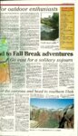
Show www.dailyutahchronicle.com or outdoor enthusiasts ^nity for students who have to stick around Salt like City but still want to utilize the time off from 'hool. Find what it is that drives outdoor enthusiasts to gden by first visiting the Wasatch-Cache NationForest. With 309,000 acres of designated wilderiss, you'll find plenty to do—whether it's hiking, ountain biking, camping, fishing or off-roading. For a small challenge, head to Ogden's highest ew: Ben Lomond Peak. At 9,712 feet, you'll get a Utastic view over northern Utah accompanied by sense of achievement. Ogden is also home to Utah's only Whitewater lyak park. Stop by Ogden's Kayak Rodeo Park on e Weber River to enjoy class II and III rapids as >u never have before. Even more opportunities are available for a stu:nt climber. The 26th Street Bouldering Field ovides climbers ample opportunity to test themIves and solve bouldering problems ranging from 0 to V7. Experienced climbers can also head up Ninth reet to a 40-foot crag. The rock has a range of fficulty and is top-rope accessible. If a one-of-kind hike is more what you're lookg for, Via Ferrata—up Waterfall Canyon Climbing Park—is one of Ogden's newest outdoor attractions.. One of 10 climbing parks in the world, Via Ferrata (Iron Way) invites a range of skill levels. The climbing park is fully set up with cables, stair steps, bolts and more, which means that the Waterfall Canyon Climbing Park mostly attracts beginners who crave access to higher ground and spectacular views. Helmet, harness and a park-issued shock-absorption lanyard are required to climb within the park and can be rented in the park. There is a pass that must be purchased and a guide service available for those wanting to venture from the beaten path. Pure climbing spots exist throughout the valley. Locals and shop personnel are the best people to ask about climbing spots in the Ogden area. Ogden also has a world-class sky-diving center for extremists, not to mention water skiing, wakeboarding and boating when weather and temperatures permit. As one can see, there is plenty to do outdoors in Ogden for just about anyone. This is even without mentioning the ski resorts that won't be opened for Fall Break (pending a miracle) and the ice climbing at Malwa's Waterfall. If you find yourself in Ogden and weather seems tawant to sabotage your adventures, just move indoors. The Salomon Center has tried to simulate the outdoors in its state-of-the-art facility. Catch a wave at the Flowrider and perfect your surfing skills with the biggest swells in Utah. Or fly high at iFIy as you experience indoor skydiving.. While you're there, ascend the 55-foot climbing wall at iRock, Ogden's premier indoor bouldering and rock climbing facility. When all is said and done and you've had your thrills for the day, don't get up and leave town just yet. Hit up the local comedy club, Wiseguys, for a laugh. Find directions to the local hot spots for some relaxation or enjoy some food and drink at one of Ogden's best establishments such as the Roosters Brewing Company or the Shooting Star Saloon. Whatever it is you do in Ogden during your Fall Break, please remember to be courteous and smart in the outdoors. Practice good judgment Wasatch-Cache National Forest •5 downhill ski areas •2 marinas : •5 boat sites •350 recreation residences : •3 yurt systems sj •2 rental cabins •6 scenic byways •72 campgrounds •20 interpretive or wildlife viewing sites •33 picnic areas •; :ip •68 trailheads V- " ^r•1524 miles of non-motorized trails &&• ; - : - • •245 miles of motorized trails (not including system roads) •309,000 acres of designated wilderness •385,000 acres designated for non-motorized recreation (outside of Wilderness Areas) TYLER COBB/fflr Otify Utah (bwntlt . . -'•••l;w/# •540,000 acres designated for winter motorized recreation Ogden Kayak Park is a kayak play area constructed in the Weber River. The park is located near 24th Street and 550 West. and respect the people and wildlife around you. Most of all, enjoy Ogden—it's not just a town on the way to Yellowstone anymore. a.stumpe@ chronicle.utah.edu . ' . • * ! • • • - . - • Source: www.fs.fed.us/r4/uwc/recreation/wcnf/index.shtml Fall Break adventures Go east for a solitary sojourn Christopher Kamrani ASST. SPORTS EDITOR •Y ALYSSA iAH.il/TitelkiffUrohChtwklt "Wilderness i s ^ a necessity...They will see what I meankin tuxtt* conservationist John Muir said, y f The state of Utah is blanketed with outdoor treasures beyond Muir's wildest dreams, and to common disbelief, there is more than the boisterous and trendy red rock to the south. • A not-so-hidden gem in Utah's expansive outdoor repertoire lies about 65 miles from Salt Lake City and expands east. The Uinta Mountains slowly creep from the edge of the UtahWyoming border all the way across to the edge of Summit County—a mountain range that features some of the best hidden hikes and camps in the state. Strawberry Reservoir is a must if heading toward the rising sun. Arguably the most versatile of local destinations, Strawberry, as it's so often called, is the premier destination for summer and winter outdoor recreation. With the dead of winter right around the corner, if you went to Strawberry you would definitely see a clusterformation of die-hard fishermen. Ice fishermen to be perfectly frank. However, because winter is not here yet, for those hoping for an interesting Fall Break who have the forte of a tremendous fish filet, Strawberry it is. In what is dubbed Utah's best main fishing spot, Strawberry Reservoir certainly doesn't fail to live up to the high billing. You could religiously reel in oversized rainbow and cutthroat trout— which can easily reach 2 feet in length— alongside Kokanee salmon, which is a less popular catch, but certainly a possibility. The surrounding area is littered with motor homes and busy camping sites, but the secret is to try to find a nook where you have an impressive outlook of the lake, especially now that the leaves surrounding the lake will be going through the changing of the guard. Strawberry is a massively impressive landscape with rolling hills that coincide with wildlife and rows and rows of aspen trees. Continue eastward and you will find the state's highest peak, dubbed King's Peak. The peak is 45 miles north of Duchesne. This adventurous move would be for those who are better-trained in the arts of the outdoors, especially when it comes to hiking, repelling and camping in and around King's Peak. The mountain stands 13,528 feet above sea level and has three differing hikes toward the summit. The simplest, but time-consuming, is the move up the southern slope, while the other two much more extravagant hikes can be taken from the north and east routes. If you aren't prepared or equipped to hike King's Peak, the surrounding areas are covered with vast greenness and have potential for outdoor activities. The diamond-in-the-rough of the Uintas is Long Lake, which holds no bearing to the public's opinion of the much more famed local Mirror Lake. Located north of Kamas, Long Lake^ is the typical "secretive" camping spot for any outdoor enthusiast. The mild two-mile hike up to the lake makes it easy for folks who want to carry an abundance of things. The lake features rainbow trout, and on the right day, one could nab 20—trust me, I have before. It's a majestic setting with pine trees surrounding the lake, and while you could, theoretically, fish the lake dry, the lake also offers enthusiasts 5-20 feet of enticing cliff jumping. Long Lake is something I know Muir was channeling to those he hoped to reach out to. It's a thing of pristine beauty, tucked in the wild. The Uintas are an incredibly colorful set of boondocks, but be weary, it gets cold as hell at night. c.kamrani@ chronicle.utah.edu of the canyons and head to southern Utah year is in the mid 70s but varies with the time of day and weather of that week. A popular location to backpack in GCNRA is in Coyote Gulch. A place of outstanding beauty that it is often difficult for the mind to comprehend, with its mysterious sandstone walls, how something naturally made can be so beautiful. This desert landscape is abundant in water, so it is easy to do any backcountry hiking and camping. Before the reservoir, the area was abundant in springs and oases, but most of that landscape is backed over with water. There are also more side canyons located in the different parts in GCNRA. If you go up toward Hite, you can see the bottom part of Cataract Canyon, which is part of Canyonlands National Park. If you head down to the Glen Canyon Dam, you can see the huge 710-foot wall inside the old river channel. Zion Located close to St. George, Utah, Zion National Park is a magnificent area with towering sandstone walls. The classics such as the Virgin Narrows, a magnificent canyon where the walls are about 2,000 feet high and at one point the canyon is 20 feet wide, the Virgin River typically flows at a low level, so you can hike through it. However, check with a ranger just to make sure the conditions aren't dangerous. If you go, make sure you have a wet- suit to keep warm, and canyoneering boots can be rented in the town, right outside of the park. Another classic hike is Angel's Landing, where you hike up 1,500 feet over a short period of time and which involves sheer cliffs on each side while heading to the summit. There, hikers are rewarded with an incredible view of the whole canyon and the Virgin River below. There is also an incredible hike down the Subway, which is a narrow tube shaped canyon that is unique, i You will need some repelling experience as the area calls for it in a few spots. Zion also has an excellent bus system, so you can easily go inside the park and leave your vehicle at the visitor's center and head up the canyon. For your information: The desert is a dry place, so water is a big issue. You will often not be able to find it, so you will need to pack it with you. It is recommended you drink at least a gallon a day. Pay attention to weather because flash floods can happen even when there is not a cloud in the sky, so if you hear a sound like a train derailing heading toward you, get to higher ground! Because of the exotic landscape of the canyon country it is important to have maps of where you plan to be. It is important to have a compass and know your plan. Please also keep in mind Leave No Trace ethics. Plan ahead and prepare. Respect wildlife. Respect other visitors. Leave what you find. Camp and travel on durable surfaces. Dispose of human waste properly and use fire re- sponsibly. For more information, visit www. lnt.org. Please, follow these ethics, as these places are everybody's land. Leave it how you would want other people to see it. Have fun, be safe and have a wonderful Fall Break, n.rosenberger@chronicle.utah.edu Waiting at the end of Zion's classic Angels Landing hike is an incredible view of the canyon and Virgin River. |