| OCR Text |
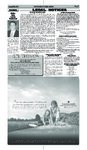
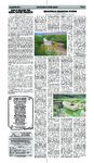
Show Page 9 The Garfield County Insider August 13, 2009 $154.8 MILLION FOR RURAL WATER PROJECTS Recovery Act Funds Will Help Improve Infrastructure in Rural Areas of 15 States Agriculture Deputy Secretary Kathleen Merrigan today announced the selection of $154.8 million in water and environmental project loans and grants that are being funded immediately through the American Recovery and Reinvestment Act. The projects will help provide safe drinking water and improved wastewater treatment systems for rural towns and communities in 15 states and Puerto Rico. Altogether, USDA has announced $1.29 billion for water and environmental project loans and grants, benefiting people throughout the country. “The 36 Recovery Act water and wastewater projects announced today further the Obama administration’s goal to rebuild and revitalize the nation’s rural infrastructure,” Merrigan said. “These projects will put people to work, improve the health of families and communities, and make a down payment on a better environment for the future.” Among the projects announced today include a $5,569,000 loan and a $3,603,000 grant for the Town of Brian Head, Ut. The water system for the Town is in need of various improvements. The project includes acquisition of water rights instead of leasing, replacement of the existing Redwood Water Tank with a one million gallon, buried concrete tank, and the development of an additional underground water source and infrastructure along with transmission piping. The existing Redwood Tank poses numerous problems. The tank is currently leaking and has been declared deficient by the Division of Drinking Water. The tank roof and sidewall have been noted as unstable with the possibility of contaminated water intrusion. The tank is used as part of the town’s fire protection and if it were to become inoperable it would leave the town with fire fighting limitations. With the constant repairs and operational challenges due to freezing, maintenance of the tank is very time consuming and costly for the Town. The current water sources are near capacity, no outdoor use is currently allowed. The new well will give the Town the much needed redundancy and the ability to service future growth. The ARRA funding announced today is being administered by USDA Rural Development’s Water and Environmental Program which provides loans and grants to ensure that the necessary investments are made in water and wastewater infrastructure to deliver safe drinking water and protect the environment in rural areas. Funding of individual recipients is contingent upon their meeting the terms of the loan or grant agreement. President Obama signed The American Recovery and Reinvestment Act of 2009 into law on Feb. 17, 2009. It is designed to jumpstart the nation’s economy, create or save millions of jobs and put a down payment on addressing long-neglected challenges so our country can thrive in the 21st century. The Act includes measures to modernize our nation’s infrastructure, enhance energy independence, expand educational opportunities, preserve and improve affordable health care, provide tax relief, and protect those in greatest need. More information about USDA’s Recovery Act efforts is available at www.usda.gov/recovery. More information about USDA rural Development is available @ www.rurdevusda.gov/ut A NOTE IN PASSING This might be my very last poem. You ask, “How can that be?” Obama’s gonna come to town and do away with me. I’m old, therefore disposable, and therefore better off dead. A burden, I, to Medicaid, some lady in Congress said. I wonder how they’ll do me in, when it’s my turn to pass? I hope it’s not a firing squad. Guns are, like, so crass. What if a big black helicopter dropped me on Bill O’Reilly? That would be kind of cool, eh? I could go out all smiley. Maybe I’m over-reacting, but I’m afraid, you see. I know that’s what they’re gonna do. I heard it from the GOP. Poems written by Ray Conrad www.raymondconrad.com Full Time Professional Real Estate Services Serving Escalante, Boulder & St. George www.trailsendre.com For Great Real Estate Service.... Come Visit Us at 10 W. Main St., Escalante or Call Leslie Venuti 435-668-0540 or Denise Olson 435-680-4663. We can show all properties in the area and assist you with all your buying or selling needs. Escalante Brick home on .32 acre lot with 3 bdrms, shed, wood floors & new roof. $112,000. .79 Acre Lot in town w/ full utilites, tack shed, 1 share Irrigation & carport. Ready for new home. Only $65,000. Newer 2 story home on 5+ acres with full basement / apt, 7 bdrms, 4 baths, Irrigation water, gas fireplace. Reduced Several lots in Moqui Gardens w/ water meter. $8,000 tax credit is still available, but expires on 12/1/2009. Don’t wait, call for details. CIRCLEVILLE IRRIGATION SYSTEM Continued from earlier By Don Southworth, Sagebrush Consultants, L.L.C., Ogden, Utah The Sevier River and its tributary Otter Creek supply much of the water utilized for culinary and irrigation in the major valleys of Piute County. While these rivers were a valuable resource for the various ranches, farms, and communities located along their banks, these rivers presented major problems in the ed railroad construction in the area until April 6, 1898. About 8:30 that morning, residents of the town of Joseph heard an explosion of some kind coming from Marysvale Canyon. The dam had given way and a ten-foot wall of water descended upon the farms and communities in the Sevier River Valley. By the time form of flooding. During spring runoff in unusually wet years, torrents of waters washed into the lowlying areas and through the narrow canyons causing major damage to roads, the railroad, and farms. During dry years, the lack of sufficient water has caused crops to wither and animals to suffer. The Sevier River, which also provided water for farmers and communities in Garfield, Sevier, and Millard Counties, was not always dependable as droughts affected its water level, as well. Two problems faced the early settlers of the region, drought and flooding. Fortunately, both problems could be solved with the construction of reservoirs and dams. In 1895-96, the Marysvale Reservoir Company built the first dam on the Sevier River about four miles north of Marysvale. The dam was constructed of rock and earth, which measured approximately 500 feet long and from 10-25 feet thick. The walls for the bulkhead were 27 feet high and 10 feet thick. The 40 feet spillway and the bulkhead were both constructed of rock laid in lime mortar. The reservoir behind the dam averaged 13 feet deep and covered an area of approximately 1700 acres. The Marysvale Reservoir Company then constructed a second dam, similar in specifications, two miles north of Marysvale at the head of the canyon. Problems occurred when the dam, which was not deep enough to contain the spring run-off, began to inundate the surrounding farms, especially those farms laying between the two dams. The property owners obtained a restraining order against the Company, which the Marysvale Reservoir Company ignored. When the county roads began to flood, the Piute County Commission went to court and had the dam declared a nuisance. The Denver and Rio Grande Railroad began making plans to extend its southern spur to Marysvale, but the railroad construction engineer was concerned about the potential damage to the railroad from the Marysvale Reservoir Company dams. He also had the dams declared unsafe. The unsafe dam effectively halt- the waters reached Circleville, the residences had fled to higher ground with their livestock. Farmers continued to work their farms, but the fields near the river were blanketed with a layer of silt and rubble. It took years for the farmland to fully recover and become completely productive again. Although it was rumored that the dam had been dynamited, it was never proven. The Marysvale Reservoir Company soon failed and went out of business. The Denver and Rio Grande Railroad was eventually able to bring its railroad line into Marysvale. The need for a reservoir generated the construction of three dams on the Sevier River near the town of Hatch, one in 1903, 1906, and again in 1913. These dams were constructed of earth and rock. However, all of the attempts at constructing the Hatch Reservoir failed catastrophic a l l y. Eventually, a new dam, called the Piute Dam, was able to help alleviate some of the flooding during the 1913 flood and spared many farms and communities downstream. Cycles of drought and flooding contributed to the decision to build two new large reservoirs in Piute County, one at the junction of Otter Creek and the East Fork of the Sevier River north of Antimony and the other on the Sevier River north of the junction. Construction on the Otter Creek Reservoir began in 1897 and took three years to complete. Major work on the dam was completed by 1901. The reservoir holds up to 52,500 acre-feet of water for irrigation and has become an important recreation location, as well as a wildlife habitat. In 1907, construction on the Piute Reservoir was commenced. The new dam was located on the Sevier River southeast of the town of Junction. The dam was completed in 1913 and effectively contained the flooding of the failed Hatch Reservoir. The Piute Reservoir, which was excavated to bedrock and constructed of concrete, and the Otter Creek Reservoir have proved to be much safer and more effective, providing storage for irrigation water and a reliable means of flood control. While dams and reservoirs were the answer to some of the irrigation problems, the Sevier River was a n o t h e r. As early as 1871, plans were b e i n g made to construct a series of canals off of the river south of Circle Valley. These plans appear to have included the West Canal and the Old Kingston Canal, as well as the Loss Creek. By 1898, these canals were supplying irrigation to the local farms and ranches of Circle Valley. The following year, the Circleville Irrigation Company, which included the West Canal, were involved in litigation with Orson Dalton among others over water rights and flow rates. The case was filed on May 17, 1899, and settled on October 31, 1899. On August 14, 1902, the Richfield Irrigation Company filed suit against the Circleville Irrigation Company, again over water rights and flow rates. The Old Kingston Irrigation Company, which owns and operates the Kingston Canal, was incorporated in Creek Canal, was incorporated on November 18, 1952, the Loss Creek Canal appears to have been in use prior to this date, as indicated on the 1871 GLO. The canal appears to have been in operation with a primary incorporation date of 1898. While it is not entirely clear if the Loss Creek Irrigation Company was part of the Circleville Irrigation Company lawsuit, it is surmised that since the “et al” was include as part of the title with Circleville Irrigation Company, that the Loss Creek Irrigation Company was part of the action. As mentioned above, the case was filed on May 17, 1899, and settled on October 31, 1899. Again the Loss Creek Irrigation Company was probably part of the Richfield Irrigation Company suit filed on August 14, 1902, against the Circleville Irrigation Company. The Dalton Ditch is a small water feature that carries water to the lawns and gardens of the residents of Circleville. The ditch is situated on the east side of 100 East north of US 89. While the Circleville Irrigation Company, which owns and operates the Dalton Ditch, was incorporated on September 9, 1947, the Dalton Ditch appears to have been in operation as early as 1898. Orson Dalton constructed a house on the north end of 100 East in Circleville in 1898. The two-story brick Victorian residence is located on the northern end of the ditch. In 1899, the Circleville Irrigation Company et al were involved in litigation with Orson Dalton et al over water rights and flow rates. The case was filed on May 17, 1899, and settled on October 31, 1899. Presumably, this involved water for the Dalton Ditch, as well. 1912. However, the Kingston Canal may have been in use prior to that date. The canal first appears as an unnamed canal on a General Land Office map dated June 12, 1871. This map shows two “flowing” (not following contours, but general routes) lines that generally follow the present course of West and Kingston Canals. Since these lines do not show any detail nor follow a precise route along the landscape, the exact date of construction is not known. Like the West Canal may have been constructed as early as 1898. However, since the Old Kingston Irrigation Company does not appear to have been involved in any of the litigation that occurred in the early 1900s, the Kingston Canal may not have been constructed until 1912. Although the Loss Creek Irrigation Company, which owns and operates the Loss By 1966, the Circleville Irrigation Company and the Loss Creek Irrigation Company were both headquartered in Circleville. The Circleville Irrigation Co., which took water from the west fork of the Sevier River, was officially incorporated on September 9, 1947. The company irrigates approximately 3,200 acres. The Loss Creek Irrigation Company also used the west fork of the Sevier River and irrigated 1,000 acres, delivering 3,350 feet of water. The Loss Creek canal was incorporated on November 18, 1952. The other canals that irrigated the farmland surrounding Circleville were the Kingston and the Dalton, which were also using the Sevier as their source. The Kingston delivered 5,520 feet and Dalton 4,090 feet of water. These canals continue to deliver water to the surrounding area. |